place

Kensington District, Pennsylvania

1820 establishments in Pennsylvania1854 disestablishments in PennsylvaniaMunicipalities in Philadelphia County prior to the Act of Consolidation, 1854Populated places established in 1729

Kensington District, or The Kensington District of the Northern Liberties, was one of the twenty-nine municipalities that formed Philadelphia County, Pennsylvania, United States prior to the enactment of the Act of Consolidation, 1854, when it became incorporated into the newly expanded City of Philadelphia. The district was roughly bounded by Lehigh Avenue to the north; Germantown Avenue and 6th Street to the west; Cohocksink Creek to the south; and an L-shaped line formed by Frankford Avenue, Norris Street, and York Street at its northeast. The Delaware River was the eastern boundary. Today the area would include the Philadelphia neighborhoods of Olde Kensington, West Kensington and Fishtown, as well as portions of the neighborhoods of Ludlow, Hartranft, Fairhill, Northern Liberties and the current Kensington. The District of Kensington was a self-governing district between the years 1820 and 1854.

Excerpt from the Wikipedia article Kensington District, Pennsylvania (License: CC BY-SA 3.0, Authors).

Kensington District, Pennsylvania
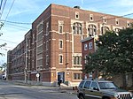
Memphis Street, Philadelphia

Geographical coordinates (GPS) Address Nearby Places
placeShow on map

Wikipedia: Kensington District, PennsylvaniaContinue reading on Wikipedia

Geographical coordinates (GPS)

Latitude Longitude
N 39.980833333333 ° E -75.122222222222 °
placeShow on map

Address

Memphis Street 2533
19125 Philadelphia
Pennsylvania, United States
mapOpen on Google Maps

Share experience

Nearby Places

Olde Richmond, Philadelphia

Olde Richmond is a neighborhood in the River Wards section of Philadelphia, Pennsylvania, United Sttes. It is notable for its historically large Polish immigrant, Polish American community, and Irish American community. The U.S. ZIP Code for Olde Richmond is 19125 and its post office is located at 1602 Frankford Avenue (in Fishtown). The neighborhood is bounded by East Lehigh Avenue to the northeast, the Delaware River to the east, Trenton Avenue to the northwest and York Street to the southwest. Some consider Frankford Avenue to be the northwestern boundary of the neighborhood, however general consensus among residents is that those who live northwest of Trenton Avenue live in Kensington. Some area residents refer to a small section or portion of Olde Richmond as "Cione", which refers to the Cione Playground and Recreation Center, which is located at 2600 Aramingo Avenue. Other sections of the neighborhood have been referred to as “Flatiron”, the section west of Aramingo Ave. named after a triangular or flatiron-shaped lot formed by the intersections of Cumberland Ave, Almond St, and Moyer St, and “Richmond”, the section east of Aramingo Ave. extending to the Delaware River. The neighborhood has also been known to Catholic residents as “Saint Anne’s”, referencing St. Anne Catholic Church and the Catholic Parish system. Adjacent neighborhoods are Port Richmond to the northeast, Kensington to the northwest, and Fishtown to the south/southwest.