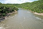
Le Sueur River
Le Sueur RiverRivers of Blue Earth County, MinnesotaRivers of Freeborn County, MinnesotaRivers of MinnesotaRivers of Steele County, Minnesota ... and 2 more
Rivers of Waseca County, MinnesotaTributaries of the Mississippi River

The Le Sueur River (lay-SEWER) is a tributary of the Blue Earth River, 111 miles (178 km) long, in southern Minnesota in the United States. Via the Blue Earth and Minnesota Rivers, it is part of the watershed of the Mississippi River, draining an area of 1,089 square miles (2,280 km2). It is the largest tributary of the Blue Earth River, draining 31% of its watershed.Le Sueur River was named for Pierre-Charles Le Sueur, a French explorer of North America.
Excerpt from the Wikipedia article Le Sueur River (License: CC BY-SA 3.0, Authors, Images).Le Sueur River
River Fort Drive,
Geographical coordinates (GPS) Address Nearby Places Show on map
Geographical coordinates (GPS)
| Latitude | Longitude |
|---|---|
| N 44.126666666667 ° | E -94.047777777778 ° |
Address
River Fort Drive
River Fort Drive
56001
Minnesota, United States
Open on Google Maps


