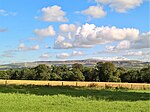
River Hyndburn

The River Hyndburn is a minor river in Lancashire, England. Beginning as Woodnook Water on the slopes of Goodshaw Hill, it passes through Stone Fold, Rising Bridge and Baxenden where it is augmented by streams from Thirteen Stone Hill and continues to the Woodnook area of Accrington. Near St James Church, it collects Broad Oak Water (recorded in 1800 as the River Grange), becoming the River Hyndburn. It heads northward through the town centre, collecting Pleck Brook and turning west, flowing under the East Lancashire railway line viaduct and continuing to Church. Here it turns northward again, meeting Hyndburn Brook just before it passes under the M65 motorway bridge to the south of Dunkenhalgh, which continues past Clayton-le-Moors and Great Harwood, ultimately joining the River Calder. Today, much of the course of the river and parts of its tributaries run underground through culverts. The Hyndburn borough of Lancashire is named after the river.
Excerpt from the Wikipedia article River Hyndburn (License: CC BY-SA 3.0, Authors, Images).River Hyndburn
Kings Highway, Borough of Rossendale
Geographical coordinates (GPS) Address Nearby Places Show on map
Geographical coordinates (GPS)
| Latitude | Longitude |
|---|---|
| N 53.736 ° | E -2.324 ° |
Address
Kings Highway
Kings Highway
BB5 2DR Borough of Rossendale
England, United Kingdom
Open on Google Maps


