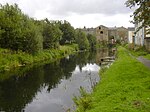
Acre, Lancashire
Geography of the Borough of RossendaleUse British English from March 2015Villages in Lancashire

Acre is a Victorian village situated along the A56 Blackburn Road between the village of Rising Bridge and the town of Haslingden in Rossendale Lancashire, about one mile north of Haslingden town centre. It was founded in 1861.
Excerpt from the Wikipedia article Acre, Lancashire (License: CC BY-SA 3.0, Authors, Images).Acre, Lancashire
Pilling Street, Borough of Rossendale Acre
Geographical coordinates (GPS) Address Nearby Places Show on map
Geographical coordinates (GPS)
| Latitude | Longitude |
|---|---|
| N 53.72 ° | E -2.324 ° |
Address
Pilling Street
Pilling Street
BB4 5AX Borough of Rossendale, Acre
England, United Kingdom
Open on Google Maps


