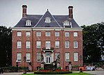
County of Buren
BurenCounties of the Holy Roman EmpireHistory of Gelderland

The Buren County was a territory situated in what is now the Dutch province of Gelderland. It was an independent county until the establishment of the Batavian Republic in 1795. Although it was not formally part of the United Provinces, in practice it was governed by it.
Excerpt from the Wikipedia article County of Buren (License: CC BY-SA 3.0, Authors, Images).County of Buren
Rijnbandijk, Buren
Geographical coordinates (GPS) Address Nearby Places Show on map
Geographical coordinates (GPS)
| Latitude | Longitude |
|---|---|
| N 51.966666666667 ° | E 5.4166666666667 ° |
Address
Rijnbandijk 28
4021 GH Buren
Gelderland, Netherlands
Open on Google Maps


