Amerongen
Former municipalities of Utrecht (province)Municipalities of the Netherlands disestablished in 2006Populated places in Utrecht (province)Utrechtse Heuvelrug

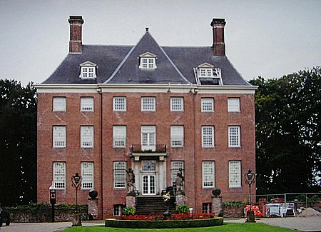
Amerongen (Dutch pronunciation: [amɛrɔŋə(n)]) is a village in the province of Utrecht, the Netherlands, on the border of the Utrecht Hill Ridge. It lies about 7 km south west of Veenendaal (10.5 km by road). The landscape rises from the flat water meadows of the Nederrijn (Lower Rhine) to the Utrecht Hill Ridge ("Utrechtse Heuvelrug"). The highest point in the western Netherlands is located 2 km east of the village. The Amerongense Berg (Amerongen Mountain) has a height of 69 metres above sea level.
Excerpt from the Wikipedia article Amerongen (License: CC BY-SA 3.0, Authors, Images).Amerongen
Prinses Beatrixlaan, Utrechtse Heuvelrug
Geographical coordinates (GPS) Address Nearby Places Show on map
Geographical coordinates (GPS)
| Latitude | Longitude |
|---|---|
| N 52.0025 ° | E 5.4608333333333 ° |
Address
parkeerplaats jumbo
Prinses Beatrixlaan
3958 KA Utrechtse Heuvelrug
Utrecht, Netherlands
Open on Google Maps


