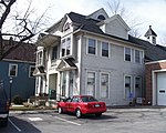
Grace Church (Scottsville, New York)

Grace Church is a historic Episcopal church located at Scottsville in Monroe County, New York. The church was designed by noted Rochester architect Harvey Ellis (1852-1904) and built in 1885. It is in the Latin cross form in the Richardsonian Romanesque style. It has a native fieldstone lower level with an upper section of frame construction with a non-structural wall of stained glass. It features rounded apsidal and transept ends topped by conical roofs. Attached is a Sunday school wing constructed in 1956 and a square, shingled bell tower added in 1976. It is a congregation in the Episcopal Diocese of Rochester. It was listed on the National Register of Historic Places in 2010.
Excerpt from the Wikipedia article Grace Church (Scottsville, New York) (License: CC BY-SA 3.0, Authors, Images).Grace Church (Scottsville, New York)
Browns Avenue, Town of Wheatland
Geographical coordinates (GPS) Address Nearby Places Show on map
 Continue reading on Wikipedia
 Geographical coordinates (GPS)
| Latitude | Longitude |
|---|---|
| N 43.022777777778 ° | E -77.751388888889 ° |
Address
Browns Avenue 9
14546 Town of Wheatland
New York, United States
Open on Google Maps