place

Van Horn Park

Landscape design history of the United StatesParks in Springfield, MassachusettsUrban forests in the United StatesUrban public parks
Van Horn Park, Springfield MA

Van Horn Park is a park in Springfield, Massachusetts' northern Liberty Heights neighborhood, in a subdivision called Hungry Hill. It is the second largest park in the City of Springfield. (The city's largest park is the 735-acre Forest Park in the southern Forest Park neighborhood.)

Excerpt from the Wikipedia article Van Horn Park (License: CC BY-SA 3.0, Authors, Images).

Van Horn Park
Bellevue Avenue, Springfield

Geographical coordinates (GPS) Address Nearby Places
placeShow on map

Wikipedia: Van Horn ParkContinue reading on Wikipedia

Geographical coordinates (GPS)

Latitude Longitude
N 42.090372222222 ° E -72.570366666667 °
placeShow on map

Address

Bellevue Avenue 65
01108 Springfield
Massachusetts, United States
mapOpen on Google Maps

Van Horn Park, Springfield MA
Share experience

Nearby Places

Forest Park, Springfield, Massachusetts

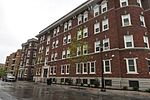
Forest Park is a Victorian garden district located in Springfield, Massachusetts, developed between 1880 and 1920. It is the city's most populous neighborhood, and surrounds the 735-acre Forest Park, for which the neighborhood is named. The Forest Park neighborhood has nature and recreation within walking distance. To the west, I-91 separates Forest Park from the Connecticut River. A 195-acre section of the neighborhood was listed on the National Register of Historic Places in 1982 as the Forest Park Heights Historic District.The 600-house Forest Park Heights Historic District was developed between 1890 and 1910, and includes gracious Colonial Revival, Tudor Revival, Queen Anne, and Shingle Style homes. This neighborhood was named one of the Northeast's "Best Old House Neighborhoods" by This Old House in 2010. East of the park is the Trafton Road area with Colonials and Tudors dating from the 1920s. Further east in this tree-filled neighborhood are pockets of American Craftsman style houses and more Colonials. Within the park for which the neighborhood is named are a zoo, walking and hiking trails, promenades, playgrounds, lakes and ponds, a formal rose garden, the Barney Carriage House, sculptures, baseball diamonds, basketball courts, tennis courts, bocce courts, lawn bowling fields, and a hockey arena, Cyr Arena. During the winter holiday season, the park features a lighting display, Bright Nights, a 2.6-mile trail of large, intricate, animated lighting displays. The 18-hole Franconia Municipal Golf Course is also in the neighborhood. Georgetown, on the Longmeadow town line, is the neighborhood's largest condominium complex, and there are smaller condo complexes in the area.Forest Park also contains a branch library, the Jewish Community Center, and a commercial district known as the "X," at the intersection of Sumner Avenue, Belmont Avenue, and Dickinson Street.

Ames Hill/Crescent Hill District

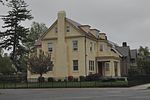
Ames Hill/Crescent Hill District is an historic district in Springfield, Massachusetts, bounded by sections of Central, Maple, Mill, and Pine Streets, Crescent Hill, Ames Hill Drive, and Maple Court. This section of Springfield was the city's first "Gold Coast," built primarily during the early Industrial Revolution, from approximately 1812–1850. The Ames Hill/Crescent Hill Historic District includes Mulberry Street, the upper-class street made famous by Dr. Seuss's first children's book, And to Think That I Saw It on Mulberry Street, (1937.) Dr. Seuss's grandparents lived on Mulberry Street. This National Historic District overlaps somewhat with both the Ridgewood and Maple Hill Historic Districts designated by the City of Springfield.Ames Hill was named for the Ames Family of Springfield. David Ames, Jr., a Springfield paper manufacturer, was the son of Colonel David Ames, the first superintendent of the Springfield Armory. The David Ames Jr. House, at 241 Maple Street, on Ames Hill in Springfield, was built in 1826-7 and was the work of Chauncey Shepard, a prominent local architect and builder. In 1867, Solomon J. Gordon, a New York City lawyer, purchased the property and Shepard was hired to remodel the house he had built forty-one years earlier. Gordon lived in the house until his death in 1891. Today the house is known as Young House and is part of the campus of the MacDuffie School.Crescent Hill continues along the steep trajectory of Maple Street, which snakes up along a bluff overlooking the scenic Connecticut River and Connecticut River Valley. Crescent Hill also features many of Springfield's largest mansions, most of which date from the mid-19th century. Unfortunately, the Ames Hill/Crescent Hill Historic District was devastated during the June 1, 2011 Greater Springfield tornado.

Mills-Stebbins Villa

The Mills-Stebbins Villa is a historic house at 3 Crescent Hill in Springfield, Massachusetts. Described as the "best work" of architect Henry A. Sykes, this Italian style villa was built between 1849 and 1851 for John Mills, a prominent Springfield attorney. Mills died in 1861, and the villa was acquired by John Stebbins, a banker, real estate developer, and local politician. It fell into decline in the 20th century, but was rehabilitated and restored in the early 1970s.The villa is located at the top of a ridge that historically separated Springfield's downtown and working class South End from the more upscale Maple Street Hill area. It was built of brick that was probably once covered with a stucco-style mastic. The most prominent architectural feature is a tower at the front of the house that echoes the style of an Italian Renaissance campanile. The massing of the building falls away in successive stages. The brickwork is relieved by stone and wood detailing, and there are a few unusual windows on the front facade. A service wing was added to the rear of the house c. 1900.Inside the building, the formal rooms of the house were on the north side, while the central part of the house contains the bedrooms and a library. The service wing added space for a nursery on the south side. A number of rooms included full-length windows that provided access to outdoor spaces, including a patio area on the north side as well as several balconies.The villa was listed on the National Register of Historic Places in 1973, and included as a contributing property to the Ames Hill/Crescent Hill District in 1974.

Six Corners/Maple Heights, Springfield, Massachusetts

The Six Corners and Maple Heights neighborhoods are located in Springfield, Massachusetts. They are often combined for political purposes, although they feature dramatically different political and socioeconomic characteristics. The political entity known as Six Corners includes the architecturally significant Maple Heights and Ridgewood Historic Districts. Bordering the urban Metro Center neighborhood, several blocks south of Main Street, Maple Heights and the Ridgewood Historic District feature prominent mansions built along a high bluff overlooking the Connecticut River. From the 1820s until the 1910s, these districts were Springfield's street-car suburbs, and served as the city's first "Gold Coast."Mulberry Street, a tourist spot made famous by Springfield native Dr. Seuss's first children's book, "'And to Think that I Saw It on Mulberry Street,'" allows fans to follow in the steps of a young Dr. Seuss.Today, in these neighborhoods, one can view majestic gilded age mansions featuring original hand-crafted woodwork and ironwork that is unable to be replicated today. The Ridgewood District also contains Mulberry House, a 1950s futurist-style apartment building, now condominiums, with unparalleled views of Springfield's skyline. Behind Ridgewood Terrace and Mulberry House is the historic Springfield Cemetery, providing an oasis of green. Springfield's oldest private school, the MacDuffie School's historic campus is located in mansions on Maple Street.Six Corners, the neighborhood on the northern side of Springfield Cemetery is currently one of the city's most impoverished districts; however, the nearby Maple Heights, Ridgewood Historic District, and Mulberry Street look much as they did during the 19th century.