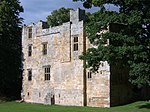
Devil's Water

Devil's Water is a narrow, powerful river in Northumberland, England fed by many streams. A right-bank firmly north-flowing tributary of the Tyne, it ends at the north end of the rural township (estate) of Dilston along which Tyne bank boundary is a widening of the Tyne and longstanding bridge to Corbridge (the parish in which Dilston lies). It is formed from smaller burns and sikes between Embley and Hackford rising 3–6 miles (5–10 km) south and south-west of Hexham.Its tributaries include the Rowley Burn and West Dipton Burn, as suggested by the northward flow of the main stream, left-bank (rising in the west). Devil's Water figured large in the Battle of Hexham, 1464, a consolidatory, strategic win in the outlying presence of deposed king Henry VI of England between a large Yorkist army and small (pro-Henry) "Lancastrian" force.
Excerpt from the Wikipedia article Devil's Water (License: CC BY-SA 3.0, Authors, Images).Devil's Water
Geographical coordinates (GPS) Address Nearby Places Show on map
Geographical coordinates (GPS)
| Latitude | Longitude |
|---|---|
| N 54.9746 ° | E -2.0395 ° |
Address
Market Place
NE45 5AW
England, United Kingdom
Open on Google Maps


