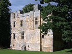
Coria (Corbridge)
Archaeological museums in EnglandCorbridgeEnglish Heritage sites in NorthumberlandFormer populated places in NorthumberlandForts of Hadrian's Wall ... and 7 more
History of NorthumberlandMuseums in NorthumberlandMuseums of ancient Rome in the United KingdomRoman auxiliary forts in EnglandRoman sites in NorthumberlandRoman towns and cities in EnglandUse British English from February 2023

Coria was a fort and town 2.5 miles (4.0 km) south of Hadrian's Wall, in the Roman province of Britannia on the junction of a major Roman north–south road (Dere Street) with the River Tyne and another Roman road (Stanegate), which ran east–west between Coria and Luguvalium (the modern Carlisle). Corbridge Roman Site is in the village of Corbridge in the county of Northumberland. It is in the guardianship of English Heritage and is partially exposed as a visitor attraction, including a site museum.
Excerpt from the Wikipedia article Coria (Corbridge) (License: CC BY-SA 3.0, Authors, Images).Coria (Corbridge)
Corchester Lane,
Geographical coordinates (GPS) Address Nearby Places Show on map
Geographical coordinates (GPS)
| Latitude | Longitude |
|---|---|
| N 54.9784 ° | E -2.03316 ° |
Address
Corchester Lane
Corchester Lane
NE45 5HW
England, United Kingdom
Open on Google Maps


