place

Merryton Low

Grade II listed buildings in StaffordshireGrade II listed monuments and memorialsHills of StaffordshireScheduled monuments in StaffordshireStaffordshire Moorlands
Staffordshire geography stubsWorld War II memorials in England
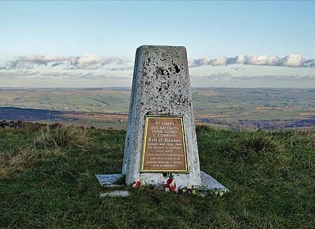
Triangulation Pillar, Merryton Low

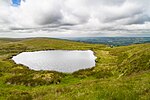
Merryton Low is a hill in Staffordshire, England, a few miles east of Leek. It is in the civil parish of Fawfieldhead in the local government district of Staffordshire Moorlands. The hill is 489m / 1604 ft ASL and forms part of the White Peak and is within the Peak District National ParkThe parent peak is Shining Tor and it ranks as the 6366th highest peak in the British Isles and the 729th tallest in EnglandThere are two bowl barrows on the hill: Merryton Low bowl barrow, a scheduled monument is at the summit, and another scheduled barrow lies 700m to the south.The summit trig point is grade II listed as it carries a plaque commemorating four members of the local Home Guard who died on active service in the regular army during World War II. The hill was the site of two fatal air crashes during World War II: a Short Stirling crashed on 13 July 1942 with eight deaths, and a Hawker Hurricane on 27 July 1944 with one death.The River Hamps rises on its southern slopes.

Excerpt from the Wikipedia article Merryton Low (License: CC BY-SA 3.0, Authors, Images).

Merryton Low
Dukes Drive, Staffordshire Moorlands

Geographical coordinates (GPS) Address Nearby Places
placeShow on map

Wikipedia: Merryton LowContinue reading on Wikipedia

Geographical coordinates (GPS)

Latitude Longitude
N 53.145948 ° E -1.939483 °
placeShow on map

Address

Dukes Drive

Dukes Drive
ST13 8UN Staffordshire Moorlands
England, United Kingdom
mapOpen on Google Maps

Triangulation Pillar, Merryton Low
Share experience

Nearby Places

Upper Hulme
Upper Hulme

Upper Hulme is a hamlet situated in North Staffordshire, between the historical market town of Leek and the spa town of Buxton. It is clustered around a redundant mill and is located within the upper reaches of the River Churnet. The Mill was recently restored, complete with a working water wheel, but no further information on its future is known. It can be accessed by one of the many footpaths through the hamlet. The Peak District Boundary Walk runs through the village.The hamlet is at the edge of the Peak District and is home to The Roaches and is therefore very popular with ramblers, climbers and hikers alike. The A53 road offers access to Tittesworth reservoir in the south and Ramshaw Rocks in the North, making the hamlet a popular base for walking holidays. There is a camp site, bunkhouse accommodation and holiday cottages available. The hamlet is popular with wildlife enthusiasts due to Wallaby having been sighted on the Roaches, and the successful annual breeding of peregrine falcons. In Peregrine breeding season, a 'bird watching post' is set up at the foot of Hen Cloud and park rangers are on hand to offer advice and information on the bird. At this time of year, some access is restricted. The hamlet has two local pubs; Ye Olde Rock Inn and The Winking Man. It is also home to a popular Tea Rooms. The main industry of the hamlet is agricultural. Upon entrance to the hamlet there is an old Dye Works, which has now been transformed into offices and workshops. Until 2005 the area was used by the British Army as a training area. That space has now been vacated by the Ministry of Defence and is currently for sale.