Thorncliffe, Staffordshire

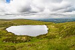
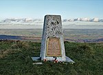
Thorncliffe is a small village in Staffordshire, England, straddling the Staffordshire Moorlands and Peak District National Park. By 1600 the name Thorncliffe had replaced the settlement's earlier name, Thorntileg, meaning "clearing in thorn trees". The nearest towns to the village are Leek (2 miles), Buxton (10 miles) and Macclesfield (14 miles). The village of Thorncliffe has only one pub, the Red Lion Inn, which dates from 1787, when it was called the Reform Inn. The village also has a small Methodist chapel and is the site of Citizen Weather Observer Program station 03330.Thorncliffe is close to a number of popular tourist attractions. The Roaches, Tittesworth reservoir, Thor’s Cave and Alton Towers are all within a few miles. The cities of Manchester, Sheffield, Derby and Nottingham are within an hour's commute of the village.
Excerpt from the Wikipedia article Thorncliffe, Staffordshire (License: CC BY-SA 3.0, Authors, Images).Thorncliffe, Staffordshire
Back Lane, Staffordshire Moorlands Tittesworth
Geographical coordinates (GPS) Address Nearby Places Show on map
Geographical coordinates (GPS)
| Latitude | Longitude |
|---|---|
| N 53.124 ° | E -1.977 ° |
Address
Back Lane
Back Lane
ST13 7LP Staffordshire Moorlands, Tittesworth
England, United Kingdom
Open on Google Maps


