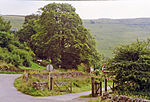
Warslow and Elkstones
Civil parishes in StaffordshireStaffordshire Moorlands

Warslow and Elkstones is a civil parish in the district of Staffordshire Moorlands in north-east Staffordshire, England. It includes the village of Warslow and the hamlets of Lower Elkstone and Uppoer Elkstone. There is a boundary with Wetton in the east at the River Manifold. To the south is Butterton; the River Hamps forms the western boundary with Onecote.
Excerpt from the Wikipedia article Warslow and Elkstones (License: CC BY-SA 3.0, Authors, Images).Warslow and Elkstones
Stoneyfold Lane, Staffordshire Moorlands Warslow and Elkstones
Geographical coordinates (GPS) Address Nearby Places Show on map
Geographical coordinates (GPS)
| Latitude | Longitude |
|---|---|
| N 53.119166666667 ° | E -1.8969444444444 ° |
Address
Stoneyfold Lane
Stoneyfold Lane
SK17 0LS Staffordshire Moorlands, Warslow and Elkstones
England, United Kingdom
Open on Google Maps


