Bryn Euryn
1997 archaeological discoveriesCommons category link is locally definedHillforts in Conwy County BoroughMountains and hills of Conwy County BoroughPages with Welsh IPA ... and 3 more
Rhos-on-SeaSites of Special Scientific Interest in ClwydUnited Kingdom Site of Special Scientific Interest stubs

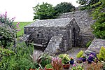
Bryn Euryn (Welsh: [ˈɛirɪn]; AYR-in) is a hill which is a Site of Special Scientific Interest in Conwy County Borough, Wales. There is a trig point at the summit. It lies above the seaside town of Rhos-on-Sea and village of Mochdre, Conwy. It is 131 metres (430 feet) above sea level, and is listed as a HuMP. At the bottom of the hill are the remains of Llys Euryn.
Excerpt from the Wikipedia article Bryn Euryn (License: CC BY-SA 3.0, Authors, Images).Bryn Euryn
Tan Y Bryn Road,
Geographical coordinates (GPS) Address Nearby Places Show on map
Geographical coordinates (GPS)
| Latitude | Longitude |
|---|---|
| N 53.30269 ° | E -3.75344 ° |
Address
Coed Craig Residential Home
Tan Y Bryn Road 35
LL28 4AD , Rhos-on-Sea
Wales, United Kingdom
Open on Google Maps


