place

Longue Vue House and Gardens

1939 establishments in LouisianaBotanical gardens in LouisianaCulture of New OrleansGardens in LouisianaGreek Revival houses in Louisiana
Historic house museums in LouisianaHouses in New OrleansHouses on the National Register of Historic Places in LouisianaLandscape design history of the United StatesMuseums in New OrleansNational Historic Landmarks in LouisianaNational Register of Historic Places in New OrleansNeoclassical architecture in LouisianaOpen-air museums in LouisianaUse American English from November 2019Use mdy dates from November 2019
Longue Vue House and Gardens

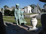
Longue Vue House and Gardens, also known as Longue Vue, is a historic house museum and associated gardens at 7 Bamboo Road in the Lakewood neighborhood of New Orleans, Louisiana, United States. The former home of Edgar Stern and Edith Rosenwald Stern (daughter of Julius Rosenwald), the current house is in fact the second. The original house and gardens began in 1924. In 1934, landscape architect Ellen Biddle Shipman began to work with the Sterns on the designs of their gardens. Through the re-working of the gardens the Sterns decided that their house did not allow them to fully enjoy their new grounds, and the original house was subsequently moved and a new one erected in its place starting in 1939. This new house was designed by architects William and Geoffrey Platt whose father, Charles A. Platt, was Shipman's mentor. The four facades of the house have four different appearances and out each of the four sides there is a different garden. It has 20 rooms on three stories, with original furnishings. The gardens include Arecaceae, Asclepias tuberosa, azaleas, caladium, Callicarpa americana, camellia, Canna, Chionanthus retusus, chrysanthemum, crape myrtle, cyclamen, Delphinium, Ficus carica, Gossypium, hydrangea, Koelreuteria bipinnata, Louisiana irises, Lycoris aurea, Narcissus, Passiflora incarnata, Phytolacca americana, Euphorbia pulcherrima, roses, Stigmaphyllon ciliatum, tulips, vitex, and Zingiber zerumbet. Longue Vue was listed on the National Register of Historic Places in 1991, and further was declared a National Historic Landmark in 2005. It was deemed nationally significant for its association with Shipman, and as the only major work of Shipman's where she exerted complete creative control over the landscape.Following damage by Hurricane Katrina, volunteer and staff labor later enabled the house to reopen for tours.

Excerpt from the Wikipedia article Longue Vue House and Gardens (License: CC BY-SA 3.0, Authors, Images).

Longue Vue House and Gardens
Garden Lane, New Orleans Hollygrove

Geographical coordinates (GPS) Address Nearby Places
placeShow on map

Wikipedia: Longue Vue House and GardensContinue reading on Wikipedia

Geographical coordinates (GPS)

Latitude Longitude
N 29.976752777778 ° E -90.123091666667 °
placeShow on map

Address

Garden Lane
70118 New Orleans, Hollygrove
Louisiana, United States
mapOpen on Google Maps

Longue Vue House and Gardens
Share experience

Nearby Places

Country Club Gardens

Country Club Gardens is a residential neighborhood in Planning District Five (D5) of New Orleans, Louisiana, in the United States comprising homes along six streets: Bamboo Road Bellaire Drive Fairway Drive Garden Lane Maryland Drive Metairie RoadThe area is bound to the north by the Lakewood neighborhood, and is separated from that area by the raised right-of-way of the Norfolk Southern Railway; to the east by the Metairie Cemetery and the golf course of the New Orleans Country Club; and, to the south and West, by the 17th Street Canal, one of the main arteries draining rain water out of the city and north to Lake Pontchartrain. Because of the physical location and the street network, the neighborhood enjoys one of the lowest crime rates in the city of New Orleans. The Metairie Ridge, a natural levee formation of the Bayou Metairie (no longer extant, except in City Park) along whose course Metairie Road now proceeds, trends through the neighborhood and provides above-sea-level elevation for much of the land situated within a quarter of a mile of Metairie Road. The three streets north of Metairie Road, Maryland, Bellaire and Fairway are connected via lanes named after women in the Friedrichs family which owned the plantation which comprised the land before it was sub-divided in 1924: Marguerite, Hedwige, Ethel and Natale. Longue Vue House and Gardens, a mansion on Bamboo Road, is open to the public for tours. Fairway Drive features a roundabout at the intersection with Natalie Lane which surrounds the ancient Fairway Oak. Fairway Drive is covered by a canopy of oak trees which provide residents welcome relief from the sun and humid heat of summertime New Orleans. Properties on the west side of Maryland Drive straddle the border between Orleans Parish and Jefferson Parish, and pay property taxes to both jurisdictions, the majority going to Orleans and the City of New Orleans where the street is chartered. Homeowners in the neighborhood may belong to the Country Club Gardens Association, which collects annual dues to provide increased security in the area and social gatherings to conduct neighborhood business. Timothy Hurley, a local attorney, has served the neighborhood association as its president for many years.

Bayou Metairie
Bayou Metairie

Bayou Metairie was a stranded distributary bayou that was located in present-day New Orleans, Louisiana, USA, and Jefferson Parish, Louisiana, USA, that extended from the area known as River Ridge to Bayou St. John. Bayou Metairie was filled in during the late 19th century and early 20th century although remnants of Bayou Metairie persist. The geologic record indicates that the Mississippi River 2600 years ago followed a course that became Bayou Metairie. This flow pattern gave rise to river banks through alluvial deposition in that location. With time, the course of the river shifted to its present day location, leaving behind a stranded waterway that was Bayou Metairie. Its river banks of its past course remained as the long narrow strip of higher ground that is known as the Metairie - Gentilly Ridge. This ridge as it followed Bayou Metairie was as much as a mile wide at its beginning, becoming much narrower as it progressed eastward, with a height of approximately seven feet. Water flow from the Mississippi River into Bayou Metairie was intermittent until approximately the year 1700 when it had ceased completely.Bayou Metairie meandered 20 miles eastward through present-day Jefferson Parish and Orleans Parish, following a path approximately parallel to the present course of the Mississippi River. Eventually Bayou Metairie developed a northward outlet to Lake Pontchartrain, the outlet becoming known as Bayou St. John. The sections east of Bayou St. John came to be known as Bayou Savage and Bayou Gentilly. The locations of these distributaries and the Metairie - Gentilly Ridge can be seen in the 1849 Sauvé's Crevasse map. Bayou Metairie and the narrow, elevated banks that comprise the Metairie - Gentilly Ridge had long been used by indigenous people in pre-colonial times. Subsequently, the land on the ridge was mostly used for small farms and gardens, being fertile soil on high ground, in centuries past of the region. Only intermittently was Bayou Metairie navigable, and then only by small boats, depending on wind and tide. Small colonial farms were established by 1708, pre-dating the city of New Orleans. In the early history of New Orleans, smugglers and runaway slaves made use of Bayou Metairie and the accompanying ridge.As urban development continued in the region in the late 19th century and early 20th century, Bayou Metairie was filled in, with only remnants persisting by the early 1900s. Some of the remnants include the area around Dueling Oaks in New Orleans City Park and the lagoons in the lower part of City Park. Early real estate developers promoted the location based on its easy access to New Orleans. The Metairie - Gentilly Ridge, which followed part of the course of Bayou Metairie, is presently occupied by Metairie Road in Jefferson Parish, Louisiana.Indigenous people in the region referred to Bayou Metairie as "Bayou Tchoupitoulas", while Spanish settlers knew it as "Arroyo de la Alqueria". French settlers referred to the Metairie - Gentilly Ridge as "Chemin de la Métairie".