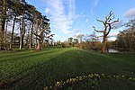
Woollens Brook
England river stubsGeographic coordinate listsHertfordshire geography stubsLea catchmentLists of coordinates ... and 3 more
Rivers of HertfordshireTributaries of the River LeaUse British English from June 2015
Woollens Brook, a minor tributary of the River Lea, rises close to Ermine Street, south of Hertford Heath (51.7745°N 0.0410°W / 51.7745; -0.0410 (Woollens Brook, source)) and flows through Box Wood in Hertfordshire. The stream flows under both the A10 and the Dinant Link Road roundabout with Amwell Street. The stream then runs parallel with Essex Road before going under it and through the Lampits where it joins another minor tributary of the River Lea, the River Lynch, at Bridgeways (51.7625°N 0.0043°W / 51.7625; -0.0043 (Woollens Brook, mouth)).
Excerpt from the Wikipedia article Woollens Brook (License: CC BY-SA 3.0, Authors).Woollens Brook
Hillside,
Geographical coordinates (GPS) Address Nearby Places Show on map
Geographical coordinates (GPS)
| Latitude | Longitude |
|---|---|
| N 51.7662 ° | E -0.0228 ° |
Address
Hillside
Hillside
EN11 8RW
England, United Kingdom
Open on Google Maps


