Gwinear–Gwithian

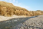
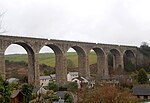
Gwinear–Gwithian (Cornish: Sen Gwynnyer–Sen Goedhyan) is a coastal civil parish in west Cornwall, England, United Kingdom. It includes the villages of Connor Downs, Gwinear, Gwithian, Reawla and Rosewarne. The parish is situated approximately two miles (3 km) east of Hayle two miles (3 km) west of Camborne.For the purposes of local government Gwinear–Gwithian has a parish council and elects councillors every four years. The principal local authority is Cornwall Council. The population of the parish was 3032 in the 2001 census. This included Fraddam and increased to 3,261 at the 2011 census. An electoral ward also exists with St. Erth added to the name. The population here in 2011 was 4,642.
Excerpt from the Wikipedia article Gwinear–Gwithian (License: CC BY-SA 3.0, Authors, Images).Gwinear–Gwithian
Prosper Hill,
Geographical coordinates (GPS) Address Nearby Places Show on map
Geographical coordinates (GPS)
| Latitude | Longitude |
|---|---|
| N 50.216666666667 ° | E -5.3833333333333 ° |
Address
Prosper Hill
Prosper Hill
TR27 5BW , Gwinear-Gwithian
England, United Kingdom
Open on Google Maps


