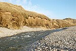
Hell's Mouth, Cornwall
Cornish coastCornwall geography stubsTourist attractions in Cornwall

Hell's Mouth (Cornish: Ganow Yfarn) is situated northeast of Gwithian on the South West Coast Path in the county of Cornwall, England, UK. The land is owned by the National Trust. It is part of a group of cliff faces in the area, with a café not far from the edge. In 2011 a jogger on the Cornish Coastal Path noticed cracks in the rock, which is made up of mudstones and sandstones of the Porthtowan Formation and slates/siltstones of the Mylor Slate Formation from the Devonian. The route of the path was diverted as the cracks enlarged. On 23 September approximately 100,000 tonnes (110,000 tons) of rock fell into the sea. Unusually the rockfall was captured on video.
Excerpt from the Wikipedia article Hell's Mouth, Cornwall (License: CC BY-SA 3.0, Authors, Images).Hell's Mouth, Cornwall
B3301,
Geographical coordinates (GPS) Address Nearby Places Show on map
Geographical coordinates (GPS)
| Latitude | Longitude |
|---|---|
| N 50.238 ° | E -5.3621 ° |
Address
B3301
TR27 5EE
England, United Kingdom
Open on Google Maps


