Red River (Koner)
Arsenic mines in CornwallCamborneMining in CornwallRivers of CornwallUse British English from February 2023

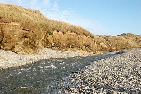
The Red River (Cornish: Dowr Koner) is a small river in north-west Cornwall, United Kingdom which issues into St Ives Bay at Godrevy on Cornwall's Atlantic coast. The Red River is about 8 miles (13 km) long and was given its name from the mineral deposits associated with tin mining, particularly oxides of Iron, which formerly coloured its water red. The river's gradient is relatively steep; the stream falls 170 metres (560 ft) from source to sea.
Excerpt from the Wikipedia article Red River (Koner) (License: CC BY-SA 3.0, Authors, Images).Red River (Koner)
Churchtown Road,
Geographical coordinates (GPS) Address Website Nearby Places Show on map
Geographical coordinates (GPS)
| Latitude | Longitude |
|---|---|
| N 50.228333333333 ° | E -5.3830555555556 ° |
Address
St Gothian's Chapel
Churchtown Road
TR27 5EE
England, United Kingdom
Open on Google Maps


