place

Jesmond Vale

Districts of Newcastle upon TyneUse British English from July 2015
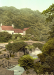
Footbridge over the Ouse Burn in Jesmond Vale geograph.org.uk 1389935

Jesmond Vale is an area in the Ouseburn Valley, Newcastle upon Tyne, England that has a rich history with industrial archaeology, mature trees, and a variety of wildlife. It is a popular open space for recreation and for walkers.

Excerpt from the Wikipedia article Jesmond Vale (License: CC BY-SA 3.0, Authors, Images).

Jesmond Vale
Fore Street, Newcastle upon Tyne Sandyford

Geographical coordinates (GPS) Address Nearby Places
placeShow on map

Wikipedia: Jesmond ValeContinue reading on Wikipedia

Geographical coordinates (GPS)

Latitude Longitude
N 54.9840701 ° E -1.5899737 °
placeShow on map

Address

Fore Street

Fore Street
NE2 1HF Newcastle upon Tyne, Sandyford
England, United Kingdom
mapOpen on Google Maps

Footbridge over the Ouse Burn in Jesmond Vale geograph.org.uk 1389935
Share experience

Nearby Places

Jesmond Dene
Jesmond Dene

Jesmond Dene, a public park in the east end of Newcastle upon Tyne, England, occupies the narrow steep-sided valley of a small river known as the Ouseburn, flowing south to join the River Tyne: in north-east England, such valleys are commonly known as denes: the name 'Jesmond' meaning 'mouth of the Ouseburn'.Lord Armstrong and his wife, of the now-demolished Jesmond Dean (sic) house nearby, first laid out the park during the 1860s. The design is intended to reflect a rural setting, with woodland, crags, waterfalls and pools. Lord Armstrong gave the park to the people of Newcastle in 1883 and it opened to the public in the following year. It is now owned by Newcastle City Council. The current Jesmond Dene House adjoining the dene was the mansion of Armstrong's business partner Andrew Noble. It is now a luxury hotel.The (now closed to road traffic) iron-constructed Armstrong Bridge spans the south end of the Dene and hosts Jesmond Food Market every first and third Saturday of the month. The building of a replacement road and tunnel, the Cradlewell By-pass, was the subject of a road protest camp around 1993, due to the destruction of many 200-year-old trees. Jesmond Dene contains a free-entry petting zoo known as "Pets' Corner", which has been a popular family attraction since the 1960s.Jesmond Dene is home to Newcastle's oldest religious building, St Mary's Chapel. The chapel, now in ruins, was once a site of much significance, attracting a great number of pilgrims.The park is supported by a group called 'Friends of Jesmond Dene' which provides funds for small projects to improve the park. There is also a group of Volunteer Rangers which carries out physical work tidying the paths, picking up litter, cutting back shrubs and other maintenance tasks. The dawn chorus of Jesmond Dene has been professionally recorded and has been used in various workplace and hospital rehabilitation facilities.In 2011, the field area and pets corner were redeveloped. The redevelopment included a new road and a bridge over the Ouseburn river.In 2012, during excessively wet weather, a landslide occurred on the east side of the Dene, near the Old Mill. The landslide covered several footpaths running along the hillside. The paths are currently still closed as the cost of re-opening them would be excessive. In July 2014, the Old Mill in the Dene was vandalised with graffiti tags, which have since been removed.On 1 April 2019, control and upkeep of Jesmond Dene, along with other Newcastle parks, was passed from Newcastle City Council to a newly created charitable trust, Urban Green Newcastle.

Byker Viaduct
Byker Viaduct

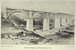
The Byker Viaduct (also known as the Byker Metro Bridge) is a 2,674 ft (815 m) curved 'S' shaped light railway bridge, which carries the Tyne and Wear Metro over the River Ouseburn in Newcastle upon Tyne. It carries the line from Manors Metro station in the city centre to the west, to Byker Metro station in the area of Byker to the east, over the lower Ouseburn valley, with the river emptying into the north side of the River Tyne, to the south. Designed by Ove Arup and Partners, and built by Mowlem, construction began in 1976 and was completed in 1979, it was opened on 11 November 1982 as part of the St James to Tynemouth section of the Metro. It is 27 ft (8.2 m) wide, and carries standard gauge double tracks up to 30m above the ground, with 18 spans up to 226 ft (69 m) long; six of the spans are over the river valley, with the remainder continuing on the east side of the valley as a lower elevated section. It was notable, in being the first such structure in Britain to be built using cantilevered concrete sections with joints glued with epoxy resin.It was one of two major bridges built specifically for the Tyne and Wear Metro, the other being the Queen Elizabeth II Bridge crossing the River Tyne.It is one of three high level bridges in close proximity making the same crossing, with the Ouseburn railway viaduct to the north and the Byker road bridge to the south. The bridge and elevated section form an S-curve, which takes the track over the Byker road bridge at its east end.