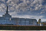
Felixstow, South Australia
Adelaide geography stubsSuburbs of AdelaideUse Australian English from August 2019

Felixstow is a suburb of Adelaide, situated in the City of Norwood Payneham St Peters. It is located approximately 6.7 km (4.2 mi) from the Adelaide city centre. It was reportedly named by Thomas Stow, who had been the first European to take up pastoral duties in the area, by combining the Latin word for "happy" with the Old English word for "place". His son, Augustine Stow, later had a vineyard at Felixstow.Felixstow Post Office opened as Hectorville Post Office on 1 July 1882 and was renamed Felixstow Post Office on 15 August 1963.The historic Forsyth House (now the Aldersgate Nursing Home) is listed on the South Australian Heritage Register.
Excerpt from the Wikipedia article Felixstow, South Australia (License: CC BY-SA 3.0, Authors, Images).Felixstow, South Australia
Briar Road, Adelaide Felixstow
Geographical coordinates (GPS) Address Nearby Places Show on map
Geographical coordinates (GPS)
| Latitude | Longitude |
|---|---|
| N -34.891 ° | E 138.644 ° |
Address
Briar Road
Briar Road
5070 Adelaide, Felixstow
South Australia, Australia
Open on Google Maps


