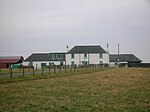
Loch Brown

Loch Brown, also known in Scots as Loch Broun, Broon or Broom, was situated in a kettle hole in the mid-Ayrshire clayland near Crosshands. It is nowadays (2011) visible as a surface depression in pastureland, partially flooded, situated in a low-lying area close to farms and dwellings of Skeoch, Dalsangan, Ladebrae, Lochhill, and Crosshands, mainly in the Parish of Mauchline and partly in Craigie, East Ayrshire, Scotland. Duveloch is an old name for the loch and this may derive from the Gaelic Dubh, meaning black or dark loch.The loch was natural, sitting in a hollow created by glaciation. The loch waters drained via the Garroch Burn that flows into the Cessnock Water and thence into the River Irvine. The road from Tarbolton to Galston via the old Largie Toll (B744) passes close to the loch site, and close by stands the hamlet of Crosshands on the Carlisle Road (A76).
Excerpt from the Wikipedia article Loch Brown (License: CC BY-SA 3.0, Authors, Images).Loch Brown
B744,
Geographical coordinates (GPS) Address Nearby Places Show on map
Geographical coordinates (GPS)
| Latitude | Longitude |
|---|---|
| N 55.54375 ° | E -4.4087777777778 ° |
Address
B744
KA5 5TP
Scotland, United Kingdom
Open on Google Maps


