Neukölln Ship Canal
1913 establishments in GermanyBerlin building and structure stubsBerlin geography stubsBuildings and structures in NeuköllnCanals in Berlin ... and 3 more
Canals opened in 1913Havel basinWater transport stubs

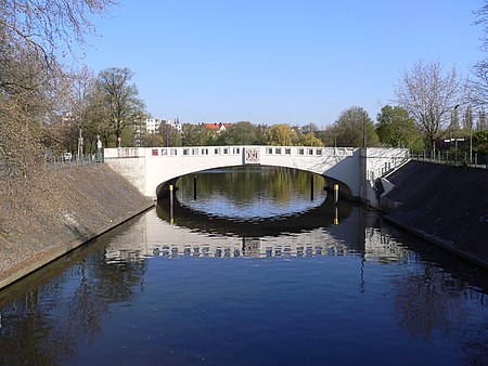
The Neukölln Ship Canal, or Neuköllner Schiffahrtskanal, is a 4.1-kilometre (2.5 mi) long canal in Berlin, Germany. It connects with the Landwehr Canal at its northern end, and with the Teltow Canal and the Britz Canal at its southern end.The canal has a single lock, the Schleuse Neukölln, towards its southern end. The lock rises from the level of the Landwehr Canal to that of the Teltow and Britz canals.
Excerpt from the Wikipedia article Neukölln Ship Canal (License: CC BY-SA 3.0, Authors, Images).Neukölln Ship Canal
Kiehlufer, Berlin Neukölln
Geographical coordinates (GPS) Address Nearby Places Show on map
Geographical coordinates (GPS)
| Latitude | Longitude |
|---|---|
| N 52.4775 ° | E 13.458055555556 ° |
Address
Kiehlufer
Kiehlufer
12059 Berlin, Neukölln
Germany
Open on Google Maps


