Rye Air Force Station
1956 establishments in New Hampshire1957 disestablishments in New HampshireAerospace Defense Command military installationsGeographic coordinate listsInstallations of the United States Air Force in New Hampshire ... and 4 more
Lists of coordinatesMilitary installations closed in 1957Military installations established in 1956Radar stations of the United States Air Force
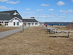
Rye Air Force Station (ADC ID: M-104) is a closed United States Air Force General Surveillance Radar station. It is located 3.1 miles (5.0 km) southeast of Portsmouth, New Hampshire in what is now Odiorne Point State Park. It was closed in 1957.
Excerpt from the Wikipedia article Rye Air Force Station (License: CC BY-SA 3.0, Authors).Rye Air Force Station
Littleton Road Nature Trail,
Geographical coordinates (GPS) Address Nearby Places Show on map
Geographical coordinates (GPS)
| Latitude | Longitude |
|---|---|
| N 43.044722222222 ° | E -70.714166666667 ° |
Address
Littleton Road Nature Trail
03854
New Hampshire, United States
Open on Google Maps


