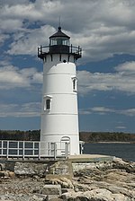
Fort William and Mary

Fort William and Mary was a colonial fortification in Britain's worldwide system of defenses, defended by soldiers of the Province of New Hampshire who reported directly to the royal governor. The fort, originally known as "The Castle," was situated on the island of New Castle, New Hampshire, at the mouth of the Piscataqua River estuary. It was renamed Fort William and Mary circa 1692, after the accession of the monarchs William III and Mary II to the British throne. It was captured by Patriot forces, recaptured, and later abandoned by the British in the Revolutionary War. The fort was renamed Fort Constitution in 1808 following rebuilding. The fort was further rebuilt and expanded through 1899 and served actively through World War II.
Excerpt from the Wikipedia article Fort William and Mary (License: CC BY-SA 3.0, Authors, Images).Fort William and Mary
Sullivan Lane,
Geographical coordinates (GPS) Address Website External links Nearby Places Show on map
Geographical coordinates (GPS)
| Latitude | Longitude |
|---|---|
| N 43.0715 ° | E -70.7095 ° |
Address
Fort Constitution Historic Site
Sullivan Lane
03854
New Hampshire, United States
Open on Google Maps


