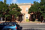
Erindale, South Australia
Adelaide geography stubsSuburbs of AdelaideUse Australian English from August 2019
Erindale is a suburb of Adelaide in the City of Burnside. It is on the east side of Glynburn Road, where it borders Leabrook. The suburb came into existence in 1912 by the sub-division of a property formerly belonging to the estate of James Cowan. Cowan had purchased the property in 1889 from John Stuart Sanders and renamed it Erindale after his place of birth.
Excerpt from the Wikipedia article Erindale, South Australia (License: CC BY-SA 3.0, Authors).Erindale, South Australia
Stanley Street, Adelaide Erindale
Geographical coordinates (GPS) Address Nearby Places Show on map
Geographical coordinates (GPS)
| Latitude | Longitude |
|---|---|
| N -34.928 ° | E 138.662 ° |
Address
Stanley Street
Stanley Street
5066 Adelaide, Erindale
South Australia, Australia
Open on Google Maps


