place

Calne Without

Calne WithoutCivil parishes in Wiltshire
Blackland Crossroads geograph.org.uk 222044

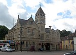
Calne Without is a civil parish in Wiltshire, England. It is a rural parish surrounding the town of Calne, extending west to the Avon and south to the Roman road from London to Bath. Settlements in the parish are the village of Derry Hill; the small villages of Calstone Wellington, Sandy Lane, Stockley and Studley; the dispersed settlement of Stock; the hamlets of Blackland, Broad's Green, Buck Hill, Mile Elm, Pewsham and Theobald's Green; and part of the hamlet of Ratford. The parish also encompasses the former tithing of Calstone, and the country house estates of Bowood and Whetham. The parish was created in 1890 when the large Calne parish was divided. The municipal area became Calne Within parish and the remainder formed Calne Without, together with the land of the abolished Blackland and Calstone Wellington parishes and the liberty of Bowood, and a small area of Bremhill parish. In 1934, Calne Without was reduced in size by transferring to Calne Within an area with a population of around 900, and transferring a smaller area to Cherhill. Finally, when Pewsham parish (to the west) was abolished in 1984 its rural area was transferred to Calne Without.The River Marden flows through the parish from its source near Calstone Wellington.

Excerpt from the Wikipedia article Calne Without (License: CC BY-SA 3.0, Authors, Images).

Calne Without
Black Dog Hill,

Geographical coordinates (GPS) Address Nearby Places
placeShow on map

Wikipedia: Calne WithoutContinue reading on Wikipedia

Geographical coordinates (GPS)

Latitude Longitude
N 51.43 ° E -2.03 °
placeShow on map

Address

Black Dog Hill
SN11 0LT , Calne Without
England, United Kingdom
mapOpen on Google Maps

Blackland Crossroads geograph.org.uk 222044
Share experience

Nearby Places

Stock, Wiltshire
Stock, Wiltshire

Stock is a small settlement and former ecclesiastical parish, now part of Calne Without civil parish, in the ceremonial county of Wiltshire, England. It lies about 1 mile (1.6 km) south of the town of Calne. Samuel Lewis said in A Topographical Dictionary of England (1848): STOCK, a tything, in the parish, union, and hundred of Calne, Chippenham and Calne, and N. divisions of Wilts; containing 328 inhabitants. It is situated on a tributary of the river Avon, and to the south of the road leading from Droitwich to Alcester. Stock was part of the Calne hundred, and its history is included in the parish history of Calne in the Wiltshire Victoria County History's Volume XVII (2002). Although Stock had open fields and common pastures, it did not have a nuclear settlement. Before the Norman Conquest of England and still in 1086 the land at Stock was almost certainly part of the royal estate of Calne. Land at Stockley lies to the south, and the boundary between Stock and Stockley is uncertain. Land at Stock had been granted away from Calne by 1144, although the area it then covered is unknown. Some of it was probably granted to Fulk de Cauntelo about 1199, and from 1763 on Stock was inherited with the manors of Calne and Calstone as part of the Bowood House estate. In 1728 Stock was divided between Hollow Ditch farm (now called Holly Ditch) and a farm now gone, with buildings near Quobbs Farm, on the west side of the road from Devizes to Calne (now the A3102). As part of the Bowood estate, the land of those two farms, and other land at Stock, totalling about 350 acres, was inherited by Charles Petty-Fitzmaurice, 9th Marquess of Lansdowne, in 1999.The Ordnance Survey map surveyed in 1884 shows a roadside hamlet named Stock Street near Stock Street Farm, and another named Mile Elm, further south along the road and near a farm of the same name which lies between Quobbs and Holly Ditch. Modern maps show only Mile Elm.