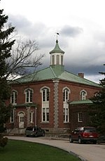
Battle of Pequawket

The Battle of Pequawket (also known as Lovewell's Fight) occurred on May 9, 1725 (O.S.), during Father Rale's War in northern New England. Captain John Lovewell led a privately organized company of scalp hunters, organized into a makeshift ranger company, and Chief Paugus led the Abenaki at Pequawket, the site of present-day Fryeburg, Maine. The battle was related to the expansion of New England settlements along the Kennebec River (in present-day Maine). The battle was the last major engagement between the English and the Wabanaki Confederacy in Governor Dummer's War. The fight was celebrated in song and story for at least several generations and became an important part of regional lore—even influencing the stories of Nathaniel Hawthorne in the early 19th century as well as other writers. Its importance is often exaggerated in local histories, as arguably the August 1724 English raid on Norridgewock was probably more significant for the direction of the conflict and in bringing the Abenaki to the treaty table. But the Norridgewock raid, also celebrated in song and poetry, has been less well remembered, probably because it was essentially a massacre of Indian civilians by New England forces.
Excerpt from the Wikipedia article Battle of Pequawket (License: CC BY-SA 3.0, Authors, Images).Battle of Pequawket
Island Road,
Geographical coordinates (GPS) Address Nearby Places Show on map
Geographical coordinates (GPS)
| Latitude | Longitude |
|---|---|
| N 44.021 ° | E -70.936 ° |
Address
Island Road 10
04037
Maine, United States
Open on Google Maps


