place

Coventry Glass Factory Historic District

Coventry, ConnecticutFederal architecture in ConnecticutGreek Revival architecture in ConnecticutHistoric districts in Tolland County, ConnecticutHistoric districts on the National Register of Historic Places in Connecticut
NRHP infobox with nocatNational Register of Historic Places in Tolland County, ConnecticutUse mdy dates from August 2023
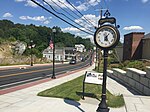
House at the corner of US Route 44 and North River Road, Coventry CT

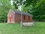
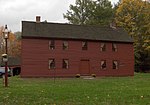
The Coventry Glass Factory Historic District is a 32-acre (13 ha) historic district in Coventry, Connecticut that was listed on the National Register of Historic Places in 1987. The listing encompasses ten historically significant houses, clustered near the site of the former Coventry Glass Factory, in a linear district along what was the Boston Turnpike, now U.S. Route 44. The Skungamaug River is a creek cutting through the district. The glassworks operated here between 1813 and about 1845, and most of these houses date to that time, exhibiting largely vernacular Federal and Greek Revival styles. The most sophisticated and best-preserved house is that of Nathaniel Root, at 1044 Boston Turnpike. The ground in the area of the glassworks (of which no structures survive) is littered with melted glass fragments and burnt brick fragments.The Coventry Glassworks was established in 1813, in part to meet demand for glass objects that had previously been fulfilled by English companies, a source cut off by the War of 1812. The glassworks founders included experienced glassblowers and local businessmen, who combined their capital and expertise. The company produced small bottles, inkstands, and flasks, and is credited with creating the first "portrait flask", bearing a depiction of the Marquis de Lafayette in commemoration of his 1825 visit to the United States. The company had a rotating cast of partners and glassblowers, and remained in operation until about 1845, when its proprietors at that time moved the business to Willington. Most of the houses in this area were built by or for either the proprietors, or the workers they hired.

Excerpt from the Wikipedia article Coventry Glass Factory Historic District (License: CC BY-SA 3.0, Authors, Images).

Coventry Glass Factory Historic District
Boston Turnpike,

Geographical coordinates (GPS) Address Nearby Places
placeShow on map

Wikipedia: Coventry Glass Factory Historic DistrictContinue reading on Wikipedia

Geographical coordinates (GPS)

Latitude Longitude
N 41.798888888889 ° E -72.350555555556 °
placeShow on map

Address

Boston Turnpike 1084
06238
Connecticut, United States
mapOpen on Google Maps

House at the corner of US Route 44 and North River Road, Coventry CT
Share experience

Nearby Places

Wangumbaug Lake
Wangumbaug Lake

Wangumbaug Lake, also known as Coventry Lake, is a natural lake located in Coventry, Connecticut. It covers 378 acres (1.53 km2) and is about 35 feet (11 m) deep and 1.8 miles (2.9 km) long with a circumference of 5 miles (8.0 km). Its watershed is 1,992 acres (8.06 km2), around 40% of which is residential and the rest farms and forest. The lake holds 2.7 billion gallons (10,220,000 m³) of water. It is fed by springs and has one natural outlet, Coventry Lake Brook, which flows southeast into the Willimantic River. Melt from a retreating glacier formed the lake 13,000 years ago.Wangumbaug means "Crooked Pond" in Algonquian. It was likely named by the Nipmuc, who settled the area before European contact.The lake has been a popular summer vacation destination for boaters and bathers. Artists flocked to the summer cottages along the shores. In the early twentieth century, a trolley line connected the towns of Coventry and Willimantic, and Wangumbaug Lake became known as "Willimantic's summer resort." A pavilion known as the Lakeside Casino was a popular dance hall. Wangumbaug Lake is currently the home of the UConn Huskies rowing team, which shares its boathouse with the Edwin O. Smith High School crew team from nearby Mansfield. A two-acre lake island, Underwood Island, is located 100 yards from Wangumbaug's shoreline. The village and census-designated place of Coventry Lake includes the lake and surrounding residential areas. The regional climate is hemiboreal.