German submarine U-1308

German submarine U-1308 was the last Type VIIC/41 submarine to be laid down, launched and commissioned by Nazi Germany's Kriegsmarine during World War II. The Oberkommando der Marine or OKM, (the German naval high command), had decided near the end of World War II to put all of its resources into building newer types of Unterseeboot, such as the types XXI and XXIII. U-1308 was part of a batch of eight U-boats (U-1301 to U-1308) ordered on 1 August 1942 to be built at Flensburger Schiffbau-Gesellschaft, Flensburg (54°48′30″N 9°26′07″E). She was laid down on 16 February 1944 and launched on 22 November. The eight boats were commissioned over a 12-month period between February 1944 and 17 January 1945 . As U-1308 was the last Type VII, the Kriegsmarine fitted her out to be one of the most advanced. U-1308 was one of nine Type VIIs that the Kriegsmarine fitted with an experimental synthetic rubber skin of anechoic tiles known as Alberich, which had been designed to counter the Allies' asdic/sonar devices. U-1308 was also one of two Type VIIC/41s that was equipped with a new design of passive sonar hydrophones, thus increasing detection ranges by approximately 70% over the older designs. A few days before Germany surrendered on 8 May 1945, U-1308 was taken approximately 5 km (2.7 nmi) north-west of Warnemünde and scuttled on 1 May at approximately 54°13′00″N 12°02′00″E. During the final days of Nazi Germany there was a plethora of U-boats which suffered the same fate. In the last week of the war, 28 other boats joined her. She would not remain on the sea floor for long however, as she was salvaged in February 1953 for potential use in East Germany's fledgling U-boat program. However, the U-1308 would ultimately be scrapped in mid 1953 following the abandonment of the East Germany's plans for a U-boat fleet.
Excerpt from the Wikipedia article German submarine U-1308 (License: CC BY-SA 3.0, Authors, Images).German submarine U-1308
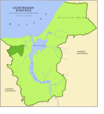
Küstengewässer einschließlich Anteil am Festlandsockel
Geographical coordinates (GPS) Address Nearby Places Show on map
Geographical coordinates (GPS)
| Latitude | Longitude |
|---|---|
| N 54.216667 ° | E 12.033333 ° |
Address
Küstengewässer einschließlich Anteil am Festlandsockel
18569 Küstengewässer einschließlich Anteil am Festlandsockel
Mecklenburg-Vorpommern, Germany
Open on Google Maps


