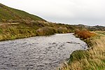
Trawscoed fort
Trawscoed fort is a Roman auxiliary fort in Ceredigion, Wales, located near the modern settlement of Trawsgoed and is cut through by the modern B4340 road. It was first built in the 70s AD. and was occupied until around 130 AD, housing up to 800 infantry in rows of barracks within the 2.1 hectares (5.2 acres) banked enclosure. At its height it could have had a total population of around 2,000 people living at the fort and its extramural vicus. It overlooks the Roman bridge over the River Ystwyth, which is where the road from Pen-Ilwyn to Llanio crosses. In 1959, this site was initially identified via aerial photography revealing a series of parchmarks covering an area of around 20,000 square metres (2 ha). Later explorations increased the knowledge of this site.
Excerpt from the Wikipedia article Trawscoed fort (License: CC BY-SA 3.0, Authors).Trawscoed fort
Maesyfelin,
Geographical coordinates (GPS) Address Nearby Places Show on map
Geographical coordinates (GPS)
| Latitude | Longitude |
|---|---|
| N 52.333333333333 ° | E -3.9333333333333 ° |
Address
Maesyfelin
Maesyfelin
SY23 4AZ
Wales, United Kingdom
Open on Google Maps


