Lower Ninth Ward

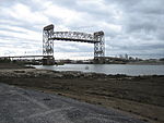
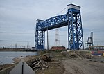
The Lower Ninth Ward is a neighborhood in the city of New Orleans, Louisiana. As the name implies, it is part of the 9th Ward of New Orleans. The Lower Ninth Ward is often thought of as the entire area within New Orleans downriver of the Industrial Canal; however, the City Planning Commission divides this area into the Lower Ninth Ward and Holy Cross neighborhoods. The term "Lower" refers to its location farther towards the mouth of the Mississippi River, downriver, "down" or "below" the rest of the city. The 9th Ward, like all wards of New Orleans, is a voting district. The 9th Ward was added as a voting district in 1852. The Lower 9th Ward is composed of Ward 9 Districts 1, 2, 4, and 7 which make up the Holy Cross Area and Ward 9 Districts 3, 5, 6, and 8. Higher voting district numbers in the 9th Ward (8–27) are on the upriver side of the Industrial Canal. The area came to international attention for its devastation in the aftermath of Hurricane Katrina in 2005.
Excerpt from the Wikipedia article Lower Ninth Ward (License: CC BY-SA 3.0, Authors, Images).Lower Ninth Ward
Fats Domino Avenue, New Orleans
Geographical coordinates (GPS) Address Nearby Places Show on map
Geographical coordinates (GPS)
| Latitude | Longitude |
|---|---|
| N 29.970277777778 ° | E -90.012777777778 ° |
Address
Fats Domino Avenue 1913
70117 New Orleans
Louisiana, United States
Open on Google Maps


