Midvale, Western Australia
Perth, Western Australia geography stubsSuburbs and localities in the City of SwanSuburbs and localities in the Shire of MundaringSuburbs of Perth, Western AustraliaUse Australian English from March 2014

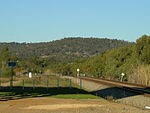
Midvale is a suburb of Perth, Western Australia, which is split between the City of Swan and the Shire of Mundaring. Its postcode is 6056. Developed in the early 1950s, the area was named as a composite of Midland and the former Helena Vale Racecourse. The former racecourse site is now part of Midvale. Its southern boundary is the Great Eastern Highway, and eastern the Eastern Railway. A substantial amount of the housing in the suburb is known as State Housing; a significant amount of this housing was redeveloped by the Department of Housing under the "Eastern Horizons New Living Project".
Excerpt from the Wikipedia article Midvale, Western Australia (License: CC BY-SA 3.0, Authors, Images).Midvale, Western Australia
Beaconsfield Avenue, Shire Of Mundaring
Geographical coordinates (GPS) Address Nearby Places Show on map
Geographical coordinates (GPS)
| Latitude | Longitude |
|---|---|
| N -31.888 ° | E 116.026 ° |
Address
Beaconsfield Avenue
Beaconsfield Avenue
6056 Shire Of Mundaring, Midvale
Western Australia, Australia
Open on Google Maps


