place

Waltherson, Baltimore

Baltimore geography stubsNeighborhoods in BaltimoreNortheast Baltimore

Waltherson is a neighborhood located in Northeast Baltimore, Maryland, United States that runs between Harford Road to Belair Road and from Hamilton Ave in the north and Southern Ave in the south. It was later expanded to include the neighborhood of Wilson Heights extending its boundaries along Belair Road to Moravia Road to achieve the boundaries currently seen on Baltimore City's CityView page.Those living along the Harford Road side of the neighborhood will often refer to the area as part of the more well known names of Hamilton, Baltimore based on the business district that historically extended along Waltherson's western boundary. More recently the older name of Lauraville, Baltimore has been used due to their participation in and as a result of the branding and marketing efforts of the now defunct Neighborhoods of Greater Lauraville, Healthy Neighborhoods, and later Hamilton-Lauraville Mainstreet. Healthy Neighborhoods refers to homes in Waltherson as part of Greater Lauraville on their website.The eastern parts of Waltherson along Belair Road (and the adjacent Frankford, Baltimore) are often called Gardenville, a historic name for that area. The name Gardenville can still be seen in the names of the shopping center at Frankford Ave and Belair Road, the Gardenville Belair Road Business Association, and the adjacent Gardenville Elementary School.

Excerpt from the Wikipedia article Waltherson, Baltimore (License: CC BY-SA 3.0, Authors).

Waltherson, Baltimore
Gibbons Avenue, Baltimore Hamilton

Geographical coordinates (GPS) Address Nearby Places
placeShow on map

Wikipedia: Waltherson, BaltimoreContinue reading on Wikipedia

Geographical coordinates (GPS)

Latitude Longitude
N 39.343611111111 ° E -76.556111111111 °
placeShow on map

Address

Gibbons Avenue 3709
21206 Baltimore, Hamilton
Maryland, United States
mapOpen on Google Maps

Share experience

Nearby Places

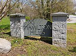
Hamilton Hills, Baltimore

Hamilton Hills is a mixed-use suburban neighborhood located in the northeastern corner of Baltimore City, Maryland. Hamilton Hills represents a section of Hamilton, a larger historic area that includes other neighborhoods in Northeast Baltimore. The neighborhood's borders are Old Harford Road and Harford Road to the east, Echodale Avenue to the south, Perring Parkway to the west and the Baltimore County line to the north. The main thoroughfare in Hamilton Hills is Harford Road, which has been an integral part of the area's history. The larger Hamilton area was sparsely populated until the late 18th century, the period when Harford Road was built. Hamilton began as a small, rural village surrounded by farmland during the 19th century. The land that became Hamilton Hills was a part of Baltimore County until 1918, when Baltimore City annexed it. Real estate developers arrived in the 20th century to build houses, and entrepreneurs formed a main street corridor on Harford Road. The Hamilton area was described throughout the 20th century as a desirable, family-oriented suburb in Baltimore City. The community has experienced White flight and been challenged by urban decay since the end of World War II. Residents in the 21st century have attempted to revive and protect Harford Road's main street economy as well as the reputation of the Hamilton area. Hamilton Hills was formalized in 2003 when the neighborhood association renamed the neighborhood. Hamilton Hills' population in the 21st century has remained relatively stable compared to Baltimore's overall population decline. As of 2020, Hamilton Hills was the 5th largest neighborhood in the city by total population. Compared to Baltimore as a whole, median household incomes among Hamilton Hills residents in the 2010s were higher, life expectancy was longer, crime was lower, and voter participation was higher. Hamilton Hills residents have been more likely to graduate high school than all Baltimoreans but less likely to complete college. Hamilton Hills is represented within the Baltimore City Council's 3rd District. Elementary and middle school students are zoned into three public schools, and the neighborhood is served by three post offices and a public library branch. It has two urban green spaces, one park, and a variety of cultural amenities.