place

Chimalhuacán (archaeological site)

Archaeological sites in the State of MexicoBuildings and structures in MesoamericaFormer populated places in MexicoMesoamerican sitesPages including recorded pronunciations
Pages with Spanish IPA

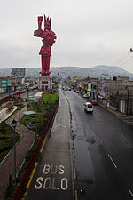
Chimalhuacán (Spanish: [tʃimalwaˈkan] ) is an archeological site located in the city and municipality of Chimalhuacán Atenco in the eastern part of Mexico State, Mexico. It lies just outside the northeast border of the Federal District (Distrito Federal). The name derives from the Nahuatl words “chimalli” (shield), hua (possession particle) and can (place), this would mean "Place of Shields".The ancient name of the city by its founders was “Chimalhuacantoyac”.The word Atenco, is also Nahuatl; A, “water”; tentli, “lip” and co, “place”, hence would mean “at the water side”.The Chimalhuacán glyph appears on the Quinatzin codex, symbolizing a round shield on a hill, has an alternative interpretation, the name Chimalltepetl = "Hill shields" or "shields site"; most probably referring to the "Chimalhuache" hill, mountain located within the municipality and near the site.It is considered one of the cradles of Mesoamerican civilization due to the finding in 1984, of the "Chimalhuacán Man", whose remains are some 12,000 old.

Excerpt from the Wikipedia article Chimalhuacán (archaeological site) (License: CC BY-SA 3.0, Authors).

Chimalhuacán (archaeological site)
Avenida Zaragoza,

Geographical coordinates (GPS) Address Nearby Places
placeShow on map

Wikipedia: Chimalhuacán (archaeological site)Continue reading on Wikipedia

Geographical coordinates (GPS)

Latitude Longitude
N 19.416666666667 ° E -98.9 °
placeShow on map

Address

Avenida Zaragoza

Avenida Zaragoza
56386 , Bonito El Manzano
State of Mexico, Mexico
mapOpen on Google Maps

Share experience

Nearby Places

Huejotla
Huejotla

Huexotla or Huexotla is an archaeological site located 5 kilometers south of Texcoco, at the town of San Luis Huexotla, close to Chapingo, in the Mexico State. Huexotla is considered to hold vestiges of the most important ancient Acolhuacan reign in the east of the Mexico highlands plateau. Although a few buildings remain in Huexotla, it was a very large city that extended well beyond the perimeter wall, in fact, the only known structure of its kind in the region from the late postclassical. It is believed that the Huexotla main structure once existed at the place where the Franciscan convent and the Church of St. Louis were built.Huexotla, Coatlinchán and Texcoco were the main Acolhua culture cities and its development began in the 13th century.These cities more than likely had a common faith and destiny, from its founding throughout 1520; they formed part of the Aztec Triple Alliance. At the time of the Spanish conquest of the Aztec Empire, it was one of the largest and most prestigious cities in central Mexico, second only to the Aztec capital, Tenochtitlan. A survey of Mesoamerican cities estimated that pre-conquest Texcoco had a population of 24,000 and occupied an area of 450 hectares.Texcoco was founded in the 12th century, on the eastern shore of Lake Texcoco, probably by the Chichimecs. In or about 1336, the Acolhua, with Tepanec help, expelled Chichimecs from Texcoco and Texcoco became the Acolhua capital city, taking over that role from Coatlinchan. In 1418, Ixtlilxochitl I, the tlatoani (ruler) of Texcoco, was dethroned by Tezozomoc of Azcapotzalco. Ten years later, in 1428, Ixtlilxochitl's son, Nezahualcoyotl allied with the Aztecs to defeat Tezozomoc's son and successor, Maxtla. Texcoco and the Aztecs of Tenochtitlan, with the Tepanecs of Tlacopan, subsequently formalized their association as the Triple Alliance. Texcoco thereby became the second-most important city in the eventual Aztec empire, by agreement receiving two-fifths of the tribute collected. Texcoco was known as a center of learning within the empire, and had a famed library including books from older Mesoamerican civilizations. Around 1960 the site was explored by Eduardo Pareyón Moreno