place

Great Boys Colliery

Coal mines in LancashireMining in LancashireTyldesleyUnderground mines in England
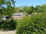
Colliers Arms, Tyldesley geograph.org.uk 691366

Great Boys Colliery was a coal mine operating on the Manchester Coalfield in the second half of the 19th century in Tyldesley, then in the historic county of Lancashire, England. It was sunk on Great Boys farm, which in 1778 was described as a "messuage with eight Cheshire acres of land" on the north side of Sale Lane west of the Colliers Arms public house. It was owned by William Atkin and sold in 1855 to mineowners, John Fletcher of Bolton and Samuel Scowcroft. By 1869 their partnership was dissolved and the company became John Fletcher and Sons in 1877. Shafts were sunk for a colliery on Pear Tree Farm on the corner of Mort Lane and Sale Lane which appear in the 1867 Mines Lists and became part of Great Boys Colliery. Fletcher and Schofield were granted permission to construct a mineral railway to join the London and North Western Railway's Tyldesley Loopline in 1868 but there is no evidence that it was built. The colliery closed before 1885. The colliery accessed the Brassey mine (coal seam) at about 170 yards and the Six Foot mine at 182 yards. The deeper coal seams were accessed by New Lester Colliery.The offices and lamproom for the pit occupied the building that is now the Colliers Arms public house, on Sale Lane.

Excerpt from the Wikipedia article Great Boys Colliery (License: CC BY-SA 3.0, Authors, Images).

Great Boys Colliery
Hood Close,

Geographical coordinates (GPS) Address Nearby Places
placeShow on map

Wikipedia: Great Boys CollieryContinue reading on Wikipedia

Geographical coordinates (GPS)

Latitude Longitude
N 53.516 ° E -2.44 °
placeShow on map

Address

Hood Close

Hood Close
M29 8PN
England, United Kingdom
mapOpen on Google Maps

Colliers Arms, Tyldesley geograph.org.uk 691366
Share experience

Nearby Places

Astley, Greater Manchester

Astley is a village in the Metropolitan Borough of Wigan, Greater Manchester, England. Within the boundaries of the historic county of Lancashire, it is crossed by the Bridgewater Canal and the A580 East Lancashire Road. Continuous with Tyldesley, it is equidistant from Wigan and Manchester, both 8.3 miles (13.4 km) away. Astley Mosley Common ward had a population of 11,270 at the 2011 Census.Astley's name is Old English, indicating Anglo-Saxon settlement. It means either "east (of) Leigh", or ēastlēah the "eastern wood or clearing". Throughout the Middle Ages, Astley constituted a township within the parish of Leigh and hundred of West Derby. Astley appears in written form as Asteleghe in 1210, when its lord of the manor granted land to the religious order of Premonstratensian canons at Cockersand Abbey. Medieval and Early Modern Astley is distinguished by the dignitaries who occupied Damhouse, the local manor house around which a settlement expanded. The Bridgewater Canal reached Astley in 1795, and the Liverpool and Manchester Railway in 1830. The Industrial Revolution introduced the factory system when the village's cotton mill was built in 1833. Coal mining became an important industry. Mining subsidence and a decline in coal production led to a reduction in the industry in the mid-20th century; its cotton mill closed in 1955, and the last coal was brought to the surface in 1970. Astley has grown as part of a commuter belt, supported by its proximity to Manchester city centre and inter-city transport links. Astley Green Colliery Museum houses collections of Astley's industrial heritage.