Boothstown

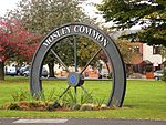
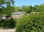
Boothstown is a suburban village in the City of Salford in Greater Manchester, England. Boothstown forms part of the Boothstown and Ellenbrook ward, which had a population at the 2011 Census of 9,599. The village is within the boundaries of the historic county of Lancashire, west of the City of Salford, bordered to the north by the East Lancashire Road A580 and to the south by the Bridgewater Canal. Historically, it was a hamlet partly in Worsley township in the parish of Eccles, and partly in Tyldesley in the parish of Leigh.Boothstown lies 5.2 miles (8.4 km) northwest of Salford, 6.8 miles (10.9 km) northwest of Manchester and 10 miles (16.1 km) southeast of Wigan. Astley is to the west, to the north is Walkden and to the east is Worsley where there is a transport interchange between the M60, M62 and M602 motorways. Once known for its mining community, Boothstown is now a mainly residential area.
Excerpt from the Wikipedia article Boothstown (License: CC BY-SA 3.0, Authors, Images).Boothstown
Linden Road, Salford
Geographical coordinates (GPS) Address Nearby Places Show on map
Geographical coordinates (GPS)
| Latitude | Longitude |
|---|---|
| N 53.5024 ° | E -2.4252 ° |
Address
Linden Road 37
M28 1JW Salford
England, United Kingdom
Open on Google Maps


