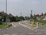
West Horndon

West Horndon is a village and civil parish in the south of the Borough of Brentwood, Essex on the boundary with Thurrock. It is located 5 miles (8 km) east of Upminster in the London Borough of Havering, East London and 20 miles (32 km) east north-east of Charing Cross in Central London. The civil parish also includes East Horndon and Dunton Hills. The village has its own parish council and forms part of the 'Herongate, Ingrave and West Horndon' ward of Brentwood Council. The local school is West Horndon Primary School, and the village falls within the Brentwood County High catchment area. West Horndon parish was abolished in 1934 and created again in 2003 with new boundaries following a petition by residents in 2002.
Excerpt from the Wikipedia article West Horndon (License: CC BY-SA 3.0, Authors, Images).West Horndon
Petresfield Way, Essex
Geographical coordinates (GPS) Address Nearby Places Show on map
Geographical coordinates (GPS)
| Latitude | Longitude |
|---|---|
| N 51.57 ° | E 0.34 ° |
Address
Petresfield Way
Petresfield Way
CM13 3TQ Essex, West Horndon
England, United Kingdom
Open on Google Maps


