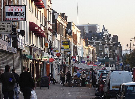
Kingsland, London
Areas of LondonCommons category link is locally definedDalstonDistricts of the London Borough of HackneyUse British English from March 2013

Kingsland was a small road-side settlement centred on Kingsland High Street on the Old North Road (the present A10), around the junction with Dalston Lane. It is no longer discernable as a separate settlement, though the historic street pattern remains. Since the opening of Dalston Junction station in 1865, the area has become known as Dalston, which was originally a separate hamlet further east. Historically part of the county of Middlesex, the area is within the London Borough of Hackney.
Excerpt from the Wikipedia article Kingsland, London (License: CC BY-SA 3.0, Authors, Images).Kingsland, London
Mortimer Road, London Dalston (London Borough of Hackney)
Geographical coordinates (GPS) Address Nearby Places Show on map
Geographical coordinates (GPS)
| Latitude | Longitude |
|---|---|
| N 51.543 ° | E -0.079 ° |
Address
Mortimer Road 121
N1 4LH London, Dalston (London Borough of Hackney)
England, United Kingdom
Open on Google Maps


