Moncloa-Aravaca
Districts of MadridMadrid geography stubsMoncloa-Aravaca

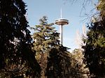
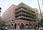
Moncloa-Aravaca is a district of the municipality of Madrid, Spain. It is located to the northwest of the city centre, spanning across both banks of the Manzanares. It is made up of the neighborhoods of Aravaca, Argüelles, Casa de Campo, Ciudad Universitaria, El Plantío, Valdemarín and Valdezarza. The Palace of Moncloa, located in Ciudad Universitaria, is the residence of the Spanish Prime Minister.
Excerpt from the Wikipedia article Moncloa-Aravaca (License: CC BY-SA 3.0, Authors, Images).Moncloa-Aravaca
Plaza de la Moncloa, Madrid
Geographical coordinates (GPS) Address Nearby Places Show on map
Geographical coordinates (GPS)
| Latitude | Longitude |
|---|---|
| N 40.435151 ° | E -3.718765 ° |
Address
Junta Municipal de Distrito de Moncloa-Aravaca.
Plaza de la Moncloa 1
28008 Madrid (Moncloa-Aravaca)
Community of Madrid, Spain
Open on Google Maps


