place

Howe Street

City of ChelmsfordEssex geography stubsGreat WalthamHamlets in EssexUse British English from March 2018
Chelmer in flood at Parsonage Bridge, Howe Street, 1990 geograph.org.uk 1653956

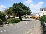
Howe Street is a rural hamlet on the banks of the River Chelmer. It is situated in the parish of Great Waltham, in the Chelmsford district, in the county of Essex, England. It is 6 miles north of the City centre. It has a population of around 200, the village post office and shop closed in 2008 and closest nearby shop and schools are located in Great Waltham 1.3 miles away. Howe Street has a Historic Grade II listed 14th-century Freehouse pub (one of the oldest in Essex) known as The Green Man, which opened 7 November 2016 to the public, after major refurbishment costing £3 million and investment being part of a new venture for renowned Essex born Michelin star chef brothers Chris and Geoff Galvin. It is one of several listed historic buildings in the hamlet many of which are well preserved examples of Early East Anglia Timber Frame construction. There is also some light industry including an active working farm known as Fitzandrews (part of the Langleys Estate) and several commercial units located at Warners Farm providing local employment. Howe Street is also known as the birthplace of Milbank Floors established by Geoffrey Milbank in 1947 however no longer based in the village they were located on the site now known as Bridge Croft - a 1980s built housing development.

Excerpt from the Wikipedia article Howe Street (License: CC BY-SA 3.0, Authors, Images).

Howe Street
Main Road, Chelmsford Great Waltham

Geographical coordinates (GPS) Address Nearby Places
placeShow on map

Wikipedia: Howe StreetContinue reading on Wikipedia

Geographical coordinates (GPS)

Latitude Longitude
N 51.807 ° E 0.457 °
placeShow on map

Address

Main Road

Main Road
CM3 1BJ Chelmsford, Great Waltham
England, United Kingdom
mapOpen on Google Maps

Chelmer in flood at Parsonage Bridge, Howe Street, 1990 geograph.org.uk 1653956
Share experience

Nearby Places

Littley Green
Littley Green

Littley Green is a hamlet in the civil parish of Great Waltham and the Chelmsford borough of Essex, England. The hamlet is at the extreme north of Great Waltham, with the nearest settlement the hamlet of Hartford End, less than 1 mile (2 km) west in the civil parish of Felsted. At the north-west edge of the hamlet and within the parish is the 319 acres (1.3 km2) residential farm of Littley Park. The house is timber framed and plastered, dates to the 16th century, and is Grade II listed. Littley Park was in the possession of Richard Rich (1496/7 – 1567), Lord Chancellor and founder of Felsted School, who gained the property after the suppression of the monasteries. It was put up for sale in 2017 at a guide price of above £5m. Other listed buildings at Littley Green included the timber framed and plastered houses, dating from the 15th to 17th century, of Bywater House, Butlers, Butlers Hall, Hope cottage, Mabb's Farmhouse, and Oak House which was formerly the Royal Oak Inn.From 1882 to at least 1914, Littley Green was in the ecclesiastical parish of Ford End, also known as Forth End, which was formed out of Great Waltham, and centred on the village of Ford End 1.5 miles (2.4 km) to the west. In 1882, Littley Green had a beer retailer and pig dealer, and one farmer at Littley Park; in 1894 two, with the extra farmer at Butler's Lodge. A licensed victualler at The Compasses public house was listed in the late 19th century to at least the First World War; in 1894 he was also a shopkeeper. In 1902, a blacksmith and beer retailer was listed, but just a blacksmith in 1914.Littley Green has a public house called The Compasses Inn.