place

Little Waltham

City of ChelmsfordCivil parishes in EssexVillages in Essex
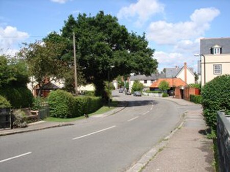
MainStreetLittleWaltham

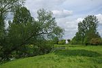
Little Waltham is a village and civil parish just north of Chelmsford, in Essex, England. It is adjacent to the village of Great Waltham. The Domesday Book refers to the two villages as Waltham, consisting of several manors. The site of an Iron Age village was excavated before upgrading the main road north between the current villages. The village straddles the River Chelmer. Its main street has a number of old houses near the bridge, notably a rare Essex example of a Wealden hall house, now divided into three cottages. A footpath leads south alongside the river to an Area of Outstanding Natural Beauty, part of which is a nature reserve. The countryside is under continued threat from housing and road development.

Excerpt from the Wikipedia article Little Waltham (License: CC BY-SA 3.0, Authors, Images).

Little Waltham
Braintree Road, Chelmsford Little Waltham

Geographical coordinates (GPS) Address Nearby Places
placeShow on map

Wikipedia: Little WalthamContinue reading on Wikipedia

Geographical coordinates (GPS)

Latitude Longitude
N 51.8 ° E 0.4833 °
placeShow on map

Address

Braintree Road

Braintree Road
CM3 3LB Chelmsford, Little Waltham
England, United Kingdom
mapOpen on Google Maps

MainStreetLittleWaltham
Share experience

Nearby Places

Chelmsford Rural District

Chelmsford Rural District was a local government district in Essex, England from 1894 to 1974. It surrounded, but did not include, the town of Chelmsford; which formed a municipal borough. It was formed as a rural district in 1894, based on the Chelmsford rural sanitary district. It included the parishes of: Boreham Broomfield Buttsbury Chignal St James Danbury East Hanningfield Good Easter Great Baddow Great Leighs Great Waltham Highwood Ingatestone and Fryerning Little Baddow Little Leighs Little Waltham Margaretting Mashbury Pleshey Rettendon Roxwell Runwell Sandon South Hanningfield Springfield Stock West Hanningfield Widford Woodham Ferrers WrittleDuring 1934 there were some changes to the district boundary. The municipal borough of Chelmsford expanded and gained 1,659 acres (7 km2) from the rural district, including parts of the parishes of Broomfield, Springfield, Widford, and Writtle. At the same time 1,282 acres (5 km2) were transferred from Buttsbury parish to form part of Billericay Urban District. Later that year, an area of 6,128 acres (25 km2), made up of Mountnessing and parts of the parishes of Downham, Ramsden Bellhouse, Ramsden Crays and Shenfield, was gained from the abolished Billericay Rural District. Also at this time 274 acres (1 km2) was gained from the parish of Hockley in Rochford Rural District. The district was abolished in 1974 and its former area was merged with the municipal borough of Chelmsford to form the current non-metropolitan district of Chelmsford, which inherited the borough charter. The parishes of Ingatestone and Fryerning and Mountnessing became part of the district of Brentwood. The former council offices in New London Road are now used as a Jobcentre Plus.

Littley Green
Littley Green

Littley Green is a hamlet in the civil parish of Great Waltham and the Chelmsford borough of Essex, England. The hamlet is at the extreme north of Great Waltham, with the nearest settlement the hamlet of Hartford End, less than 1 mile (2 km) west in the civil parish of Felsted. At the north-west edge of the hamlet and within the parish is the 319 acres (1.3 km2) residential farm of Littley Park. The house is timber framed and plastered, dates to the 16th century, and is Grade II listed. Littley Park was in the possession of Richard Rich (1496/7 – 1567), Lord Chancellor and founder of Felsted School, who gained the property after the suppression of the monasteries. It was put up for sale in 2017 at a guide price of above £5m. Other listed buildings at Littley Green included the timber framed and plastered houses, dating from the 15th to 17th century, of Bywater House, Butlers, Butlers Hall, Hope cottage, Mabb's Farmhouse, and Oak House which was formerly the Royal Oak Inn.From 1882 to at least 1914, Littley Green was in the ecclesiastical parish of Ford End, also known as Forth End, which was formed out of Great Waltham, and centred on the village of Ford End 1.5 miles (2.4 km) to the west. In 1882, Littley Green had a beer retailer and pig dealer, and one farmer at Littley Park; in 1894 two, with the extra farmer at Butler's Lodge. A licensed victualler at The Compasses public house was listed in the late 19th century to at least the First World War; in 1894 he was also a shopkeeper. In 1902, a blacksmith and beer retailer was listed, but just a blacksmith in 1914.Littley Green has a public house called The Compasses Inn.