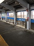
Cobbs Creek, Philadelphia

Cobbs Creek is a neighborhood located in the West Philadelphia section of Philadelphia, Pennsylvania, United States, named for the creek which forms part of Philadelphia's western border. Cobbs Creek is generally bounded by Market Street to the north, Baltimore Avenue to the south, 52nd Street to the east, and the border of Upper Darby along Cobbs Creek to the West. In 1998, the Cobbs Creek Automobile Suburb Historic District was created, with Cobbs Creek Parkway, Spruce Street, 52nd Street, and Angora Street its boundaries. The District protects 1049 buildings, with Tudor Revival, Colonial Revival, and Bungalow/Craftsman architectural styles contained within the district. Philadelphia architect William Alesker, who was involved in the plans for a Trump Tower in Center City, and Evangelical minister Tony Campolo, one of Bill Clinton's spiritual advisers, lived, respectively, in the 6200 blocks of Pine and Delancey Streets back in the 1940s and 1950s. Fires from the 1985 bombing of the MOVE headquarters at 6221 Osage Avenue spread to 64 other buildings in the neighborhood. The destroyed homes were hastily rebuilt by the city, but were later condemned after years of attempted repairs to the shoddy construction.Also listed on the National Register of Historic Places are the Holmes Junior High School and Walnut Park Plaza Hotel.
Excerpt from the Wikipedia article Cobbs Creek, Philadelphia (License: CC BY-SA 3.0, Authors, Images).Cobbs Creek, Philadelphia
Larchwood Avenue, Philadelphia
Geographical coordinates (GPS) Address Nearby Places Show on map
Geographical coordinates (GPS)
| Latitude | Longitude |
|---|---|
| N 39.952912 ° | E -75.23592 ° |
Address
Larchwood Avenue 5668
19143 Philadelphia
Pennsylvania, United States
Open on Google Maps


