place

The Island, Thompson Bend, Warrandyte

Heritage sites in MelbourneMelbourne geography stubsRiver islands of AustraliaShire of NillumbikVictoria (state) gold rush river diversions
Yarra River

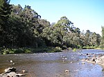
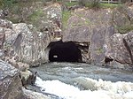
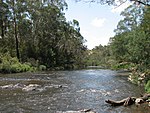
The Island is located at Thompson Bend on the Yarra River at Warrandyte, Victoria, Australia, approximately 24 kilometres (15 mi) north-east of Melbourne. It was created by gold miners in 1859–60, during the Victorian gold rush. They dug a diversion channel to alter the course of the Yarra River, providing access to the alluvial gold in the exposed river bed. The canal was widened by subsequent flooding becoming the main river course, with the previous river bed becoming a willow-choked backwater. Mining Registrars and Surveyors Reports for the St. Andrews Division date the diversion of the river into a canal as May–July 1859. The work cost £7,000. There was more work in November 1859 and February 1860. The nearby Pound Bend Tunnel was cut for a similar purpose in 1870. Two other tunnels, the Big Peninsula Tunnel and the Little Peninsula Tunnel, were dug further upstream in the 1860s. The site is listed in the Victorian Heritage Inventory.

Excerpt from the Wikipedia article The Island, Thompson Bend, Warrandyte (License: CC BY-SA 3.0, Authors).

The Island, Thompson Bend, Warrandyte
Yarra Street, Melbourne Warrandyte

Geographical coordinates (GPS) Address Nearby Places
placeShow on map

Wikipedia: The Island, Thompson Bend, WarrandyteContinue reading on Wikipedia

Geographical coordinates (GPS)

Latitude Longitude
N -37.736944444444 ° E 145.22833333333 °
placeShow on map

Address

Yarra Street (Ringwood - Warrandyte Road)

Yarra Street
3113 Melbourne, Warrandyte
Victoria, Australia
mapOpen on Google Maps

Share experience

Nearby Places

Warrandyte State Park

Warrandyte State Park is a state park, located in Warrandyte, east of Melbourne, Victoria on the banks of the Yarra River and surroundings. The park comprises 586 hectares of remnant bushland in various locations throughout Warrandyte and Wonga Park around Pound Bend, Fourth Hill, Black Flat, Yarra Brae and various other locations in the area. It hosts many significant geographical, environmental, archaeological and historical sites, such as the site of the first gold discovery in Victoria in 1851 and preserves the sites of former gold mines and tunnels. It is a popular destination for school and community groups and is frequented by local bush walkers and hikers.Land now occupied by the park was initially occupied by Indigenous Australians of the Wurundjeri nation. After European settlement, gold was discovered in Warrandyte, and the area was mined for a number of years. Frequent clearing had at one stage removed all the vegetation in the area, and bushfires have erased much of the recent human architectural history of the area. However, they have ensured the health of the bushland and reduced the impact of human settlements, enabling the vegetation to recover throughout the 20th century. The major threats to the park's ecology are introduced species of flora and fauna such as foxes, rabbits, dogs and cats. Being located close to suburban settlements, backburning is regularly undertaken within the park to minimise risk of bushfires.