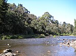
Wonga Park, Victoria

Wonga Park is a locality on the edge of Greater Melbourne, beyond the Melbourne Metropolitan Urban Growth Boundary area, 28 km north-east from Melbourne's Central Business District, located within the Cities of Manningham and Maroondah and the Shire of Yarra Ranges local government areas. Wonga Park recorded a population of 3,843 at the 2021 census. Wonga Park is bounded in the west by Jumping Creek, in the north by the Yarra River, in the east by Brushy Park and Old Homestead Roads and in the south by Holloway Road. The name comes from the Wonga Park grazing property, which itself derives from Simon Wonga, elder of the Wurundjeri indigenous people of Melbourne. The area was part of Mooroolbark until the 1890s.
Excerpt from the Wikipedia article Wonga Park, Victoria (License: CC BY-SA 3.0, Authors, Images).Wonga Park, Victoria
Launders Avenue, Melbourne Wonga Park
Geographical coordinates (GPS) Address Nearby Places Show on map
Geographical coordinates (GPS)
| Latitude | Longitude |
|---|---|
| N -37.739 ° | E 145.267 ° |
Address
Wonga Park Reserve Playground
Launders Avenue
3115 Melbourne, Wonga Park
Victoria, Australia
Open on Google Maps


