place

Warrandyte, Victoria

Mining towns in Victoria (state)Suburbs of MelbourneSuburbs of the City of ManninghamUse Australian English from August 2019
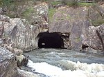
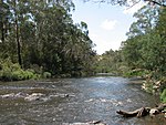
Yarra River at Warrandyte

Warrandyte is a suburb of Melbourne, Victoria, Australia, 24 km north-east of Melbourne's Central Business District, located within the City of Manningham local government area. Warrandyte recorded a population of 5,541 at the 2021 census. Warrandyte is bounded in the west by the Mullum Mullum Creek and Target Road, in the north by the Yarra River, in the east by Jumping Creek and Anzac Road, and in the south by an irregular line from Reynolds Road, north of Donvale, Park Orchards and Warrandyte South. Warrandyte was founded as a Victorian town, located in the once gold-rich rolling hills east of Melbourne, and is now on the north-eastern boundary of suburban Melbourne. Gold was first discovered in the town in 1851 and together, with towns like Bendigo and Ballarat, led the way in gold discoveries during the Victorian gold rush. Today Warrandyte retains much of its past in its surviving buildings of the Colonial period and remains a twin community with North Warrandyte, which borders the Yarra River to its north.

Excerpt from the Wikipedia article Warrandyte, Victoria (License: CC BY-SA 3.0, Authors, Images).

Warrandyte, Victoria
Brackenbury Street, Melbourne Warrandyte

Geographical coordinates (GPS) Address Nearby Places
placeShow on map

Wikipedia: Warrandyte, VictoriaContinue reading on Wikipedia

Geographical coordinates (GPS)

Latitude Longitude
N -37.738 ° E 145.223 °
placeShow on map

Address

Brackenbury Street

Brackenbury Street
3113 Melbourne, Warrandyte
Victoria, Australia
mapOpen on Google Maps

Yarra River at Warrandyte
Share experience

Nearby Places

Warrandyte State Park

Warrandyte State Park is a state park, located in Warrandyte, east of Melbourne, Victoria on the banks of the Yarra River and surroundings. The park comprises 586 hectares of remnant bushland in various locations throughout Warrandyte and Wonga Park around Pound Bend, Fourth Hill, Black Flat, Yarra Brae and various other locations in the area. It hosts many significant geographical, environmental, archaeological and historical sites, such as the site of the first gold discovery in Victoria in 1851 and preserves the sites of former gold mines and tunnels. It is a popular destination for school and community groups and is frequented by local bush walkers and hikers.Land now occupied by the park was initially occupied by Indigenous Australians of the Wurundjeri nation. After European settlement, gold was discovered in Warrandyte, and the area was mined for a number of years. Frequent clearing had at one stage removed all the vegetation in the area, and bushfires have erased much of the recent human architectural history of the area. However, they have ensured the health of the bushland and reduced the impact of human settlements, enabling the vegetation to recover throughout the 20th century. The major threats to the park's ecology are introduced species of flora and fauna such as foxes, rabbits, dogs and cats. Being located close to suburban settlements, backburning is regularly undertaken within the park to minimise risk of bushfires.