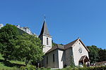
Roc de Chère National Nature Reserve
Geography of Haute-SavoieNature reserves in FranceProtected areas established in 1977Tourist attractions in Haute-Savoie

The Roc de Chère National Nature Reserve is a major ecologic site in southeastern France. A protected nature reserve since 1977, it covers a small area of 69 hectares (170 acres). It is located near the commune of Talloires, on the eastern bank of Lake Annecy at an elevation of 448 metres (1,470 ft). The Roc de Chère is a small mountain, culminating at a modest 651 metres (2,136 ft), which was formed by a quaternary glacier from the south.
Excerpt from the Wikipedia article Roc de Chère National Nature Reserve (License: CC BY-SA 3.0, Authors, Images).Roc de Chère National Nature Reserve
Chemin Rural d'Écharvines à Chère, Talloires-Montmin
Geographical coordinates (GPS) Address Nearby Places Show on map
Geographical coordinates (GPS)
| Latitude | Longitude |
|---|---|
| N 45.844444444444 ° | E 6.2044444444444 ° |
Address
Belvédère de la Crête
Chemin Rural d'Écharvines à Chère
74290 Talloires-Montmin (Talloires)
Auvergne-Rhône-Alpes, France
Open on Google Maps


