Stow-on-the-Wold
Charter fairsCivil parishes in GloucestershireCotswold DistrictCotswoldsMarket towns in Gloucestershire ... and 3 more
Stow-on-the-WoldTowns in GloucestershireUse British English from October 2019

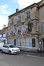
Stow-on-the-Wold is a market town and civil parish in Gloucestershire, England, on top of an 800-foot (244 m) hill at the junction of main roads through the Cotswolds, including the Fosse Way (A429), which is of Roman origin. The town was founded by Norman lords to absorb trade from the roads converging there. Fairs have been held by royal charter since 1330; a horse fair is still held on the edge of the town in May and October each year.
Excerpt from the Wikipedia article Stow-on-the-Wold (License: CC BY-SA 3.0, Authors, Images).Stow-on-the-Wold
Market Square, Cotswold District Stow-on-the-Wold
Geographical coordinates (GPS) Address Nearby Places Show on map
Geographical coordinates (GPS)
| Latitude | Longitude |
|---|---|
| N 51.93 ° | E -1.7225 ° |
Address
cotswolds hideaways
Market Square Crossways House
GL54 1AB Cotswold District, Stow-on-the-Wold
England, United Kingdom
Open on Google Maps


