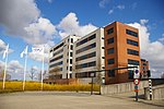
Amsterdam Airport Schiphol

Amsterdam Airport Schiphol (IATA: AMS, ICAO: EHAM), known informally as Schiphol Airport (Dutch: Luchthaven Schiphol, pronounced [ˌlʏxtɦaːvə(n) ˈsxɪp(ɦ)ɔl; sxɪpˈɦɔl]), is the main international airport of the Netherlands. It is located 9 kilometres (5.6 mi) southwest of Amsterdam, in the municipality of Haarlemmermeer in the province of North Holland. It is the world's third busiest airport by international passenger traffic in 2021. With almost 72 million passengers in 2019, it is the third-busiest airport in Europe in terms of passenger volume and the busiest in Europe in terms of aircraft movements. With an annual cargo tonnage of 1.74 million, it is the 4th busiest in Europe. AMS covers a total area of 6,887 acres (10.761 sq mi; 2,787 ha) of land. The airport is built on the single-terminal concept: one large terminal split into three large departure halls. Schiphol is the hub for KLM and its regional affiliate KLM Cityhopper as well as for Corendon Dutch Airlines, Martinair, Transavia and TUI fly Netherlands. The airport also serves as a base for EasyJet. Schiphol opened on 16 September 1916 as a military airbase. The end of the First World War also saw the beginning of civilian use of Schiphol Airport and the airport eventually lost its military role completely. By 1940, Schiphol had four asphalt runways at 45-degree angles. The airport was captured by the German military that same year and renamed Fliegerhorst Schiphol. The airport was destroyed through bombing but at the end of the war, the airfield was soon rebuilt. In 1949, it was decided that Schiphol was to become the primary airport of the Netherlands. Schiphol Airport was voted the Best Airport in Western Europe in 2020.
Excerpt from the Wikipedia article Amsterdam Airport Schiphol (License: CC BY-SA 3.0, Authors, Images).Amsterdam Airport Schiphol
Ceintuurbaan, Haarlemmermeer
Geographical coordinates (GPS) Address Nearby Places Show on map
Geographical coordinates (GPS)
| Latitude | Longitude |
|---|---|
| N 52.3 ° | E 4.765 ° |
Address
Ceintuurbaan
1118 LJ Haarlemmermeer
North Holland, Netherlands
Open on Google Maps


