Col de Cou
France–Switzerland border crossingsHaute-Savoie geography stubsMountain passes of Auvergne-Rhône-AlpesMountain passes of SwitzerlandMountain passes of Valais ... and 2 more
Mountain passes of the AlpsValais geography stubs

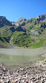
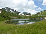
The Col de Cou (also spelled Col de Coux) (1,921 m) is a high mountain pass of the Alps, located on the border between Switzerland and France. It connects Champéry in the Swiss canton of Valais to Morzine in the French department of Haute-Savoie. It is the lowest border crossing between the Pas de Morgins and the Dents du Midi.
Excerpt from the Wikipedia article Col de Cou (License: CC BY-SA 3.0, Authors, Images).Col de Cou
Voie Communale de la RN507 au Col de Coux, Bonneville
Geographical coordinates (GPS) Address Nearby Places Show on map
Geographical coordinates (GPS)
| Latitude | Longitude |
|---|---|
| N 46.150277777778 ° | E 6.7927777777778 ° |
Address
Voie Communale de la RN507 au Col de Coux
Voie Communale de la RN507 au Col de Coux
74340 Bonneville
Auvergne-Rhône-Alpes, France
Open on Google Maps


